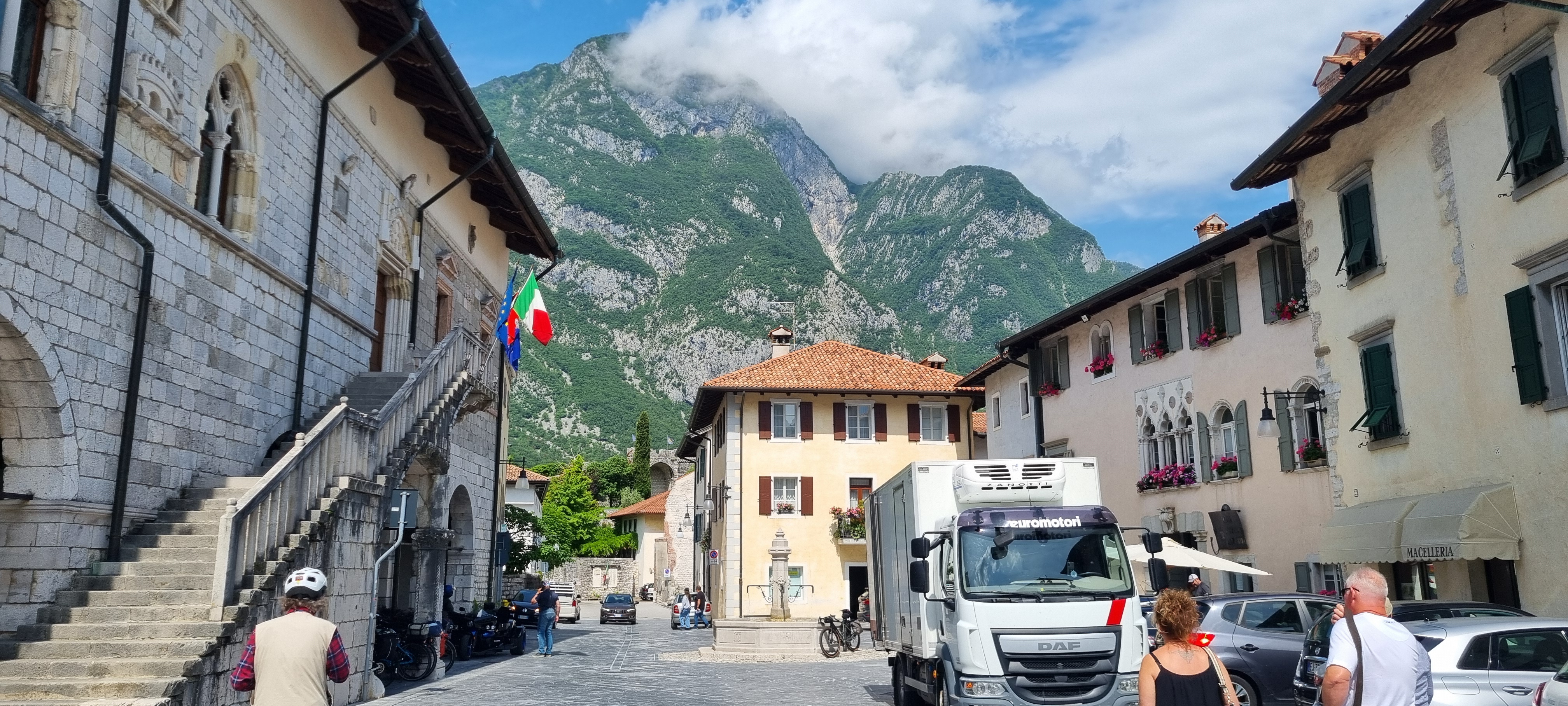
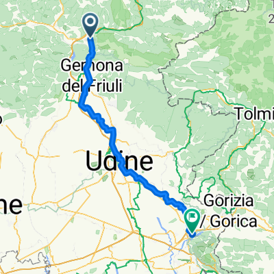
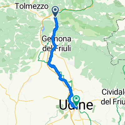
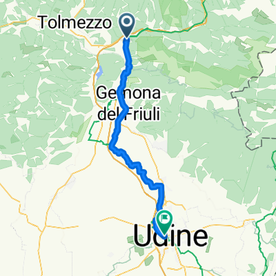
Alpe Adria Tag 5 Venzone Udine
A cycling route starting in Amaro, Friuli Venezia Giulia, Italy.
Overview
About this route
- -:--
- Duration
- 49 km
- Distance
- 215 m
- Ascent
- 366 m
- Descent
- ---
- Avg. speed
- 266 m
- Max. altitude
Route photos
Route quality
Waytypes & surfaces along the route
Waytypes
Quiet road
18.1 km
(37 %)
Road
13.7 km
(28 %)
Surfaces
Paved
43.6 km
(89 %)
Asphalt
43.1 km
(88 %)
Concrete
0.5 km
(1 %)
Undefined
5.4 km
(11 %)
Continue with Bikemap
Use, edit, or download this cycling route
You would like to ride Alpe Adria Tag 5 Venzone Udine or customize it for your own trip? Here is what you can do with this Bikemap route:
Free features
- Save this route as favorite or in collections
- Copy & plan your own version of this route
- Sync your route with Garmin or Wahoo
Premium features
Free trial for 3 days, or one-time payment. More about Bikemap Premium.
- Navigate this route on iOS & Android
- Export a GPX / KML file of this route
- Create your custom printout (try it for free)
- Download this route for offline navigation
Discover more Premium features.
Get Bikemap PremiumFrom our community
Other popular routes starting in Amaro
- 7. Etappe: von Venzone (il carnia) nach Udine (Friuli)
- Distance
- 59.5 km
- Ascent
- 322 m
- Descent
- 478 m
- Location
- Amaro, Friuli Venezia Giulia, Italy
- Bicyklovačka 2014 - 382 km/ 3370hm
- Distance
- 423.1 km
- Ascent
- 2,078 m
- Descent
- 2,350 m
- Location
- Amaro, Friuli Venezia Giulia, Italy
- 3./2 Carnia del Friuli-Udine 2021-09-21
- Distance
- 51 km
- Ascent
- 201 m
- Descent
- 360 m
- Location
- Amaro, Friuli Venezia Giulia, Italy
- Alpe Adria VII Carnia - Udine
- Distance
- 48.2 km
- Ascent
- 182 m
- Descent
- 326 m
- Location
- Amaro, Friuli Venezia Giulia, Italy
- Friaul Slowenien
- Distance
- 190.2 km
- Ascent
- 1,337 m
- Descent
- 1,334 m
- Location
- Amaro, Friuli Venezia Giulia, Italy
- Carnia-Monte Croce-Venzone
- Distance
- 97 km
- Ascent
- 1,487 m
- Descent
- 1,558 m
- Location
- Amaro, Friuli Venezia Giulia, Italy
- Carnia nach Palmanova
- Distance
- 85.9 km
- Ascent
- 256 m
- Descent
- 494 m
- Location
- Amaro, Friuli Venezia Giulia, Italy
- Variante su itinerario Tolmezzo _ Amaro_Tolmezzo
- Distance
- 4.3 km
- Ascent
- 31 m
- Descent
- 77 m
- Location
- Amaro, Friuli Venezia Giulia, Italy
Open it in the app