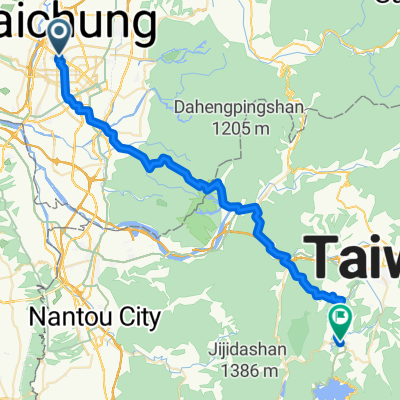
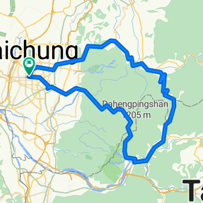
旱溪自行車道接環台中自行車道
- 28.7 km
- 132 m
- 126 m
- Taichung, Taiwan, Taiwan
A cycling route starting in Taichung, Taiwan, Taiwan.
Overview
created this 16 years ago
Route quality
Road
6.6 km
(53 %)
Quiet road
5.1 km
(41 %)
Paved
3.5 km
(28 %)
Asphalt
3.5 km
(28 %)
Undefined
8.9 km
(72 %)
Route highlights
欣欣自行車 台中市西屯路三段90~26號
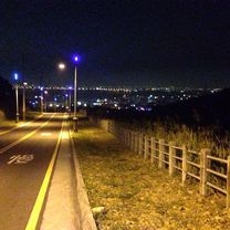
都會夜景新地標
Continue with Bikemap
You would like to ride 都會公園:夜騎路線 or customize it for your own trip? Here is what you can do with this Bikemap route:
Free trial for 3 days, or one-time payment. More about Bikemap Premium.
Discover more Premium features.
Get Bikemap PremiumFrom our community
Open it in the app