

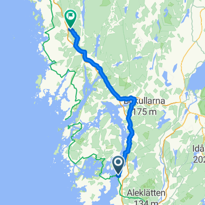
Stenungsund - Bjørkekjerr
A cycling route starting in Stenungsund, Västra Götaland County, Sweden.
Overview
About this route
null
- 2 h 47 min
- Duration
- 51.5 km
- Distance
- 352 m
- Ascent
- 285 m
- Descent
- 18.5 km/h
- Avg. speed
- 75 m
- Max. altitude

Route quality
Waytypes & surfaces along the route
Waytypes
Path
31.9 km
(62 %)
Road
6.2 km
(12 %)
Surfaces
Paved
47.4 km
(92 %)
Unpaved
1.5 km
(3 %)
Asphalt
46.4 km
(90 %)
Gravel
1.5 km
(3 %)
Continue with Bikemap
Use, edit, or download this cycling route
You would like to ride Stenungsund - Bjørkekjerr or customize it for your own trip? Here is what you can do with this Bikemap route:
Free features
- Save this route as favorite or in collections
- Copy & plan your own version of this route
- Sync your route with Garmin or Wahoo
Premium features
Free trial for 3 days, or one-time payment. More about Bikemap Premium.
- Navigate this route on iOS & Android
- Export a GPX / KML file of this route
- Create your custom printout (try it for free)
- Download this route for offline navigation
Discover more Premium features.
Get Bikemap PremiumFrom our community
Other popular routes starting in Stenungsund
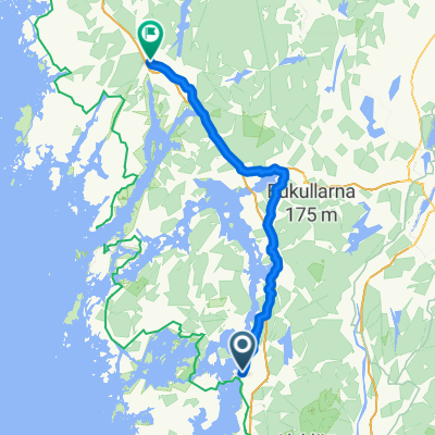
 B-O 24 Stenungsund - Noesund
- Distance
- 38.7 km
- Ascent
- 280 m
- Descent
- 282 m
- Location
- Stenungsund, Västra Götaland County, Sweden
 Uddevalla - Rakkestad
- Distance
- 87.9 km
- Ascent
- 997 m
- Descent
- 899 m
- Location
- Stenungsund, Västra Götaland County, Sweden
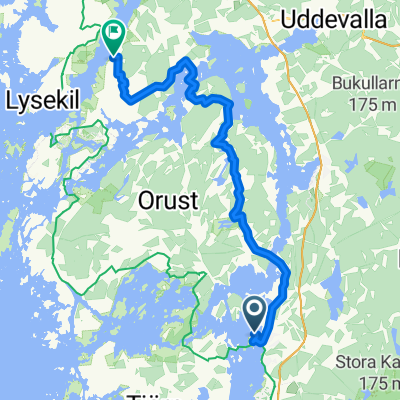
 Stenungsund nach Lysekil
- Distance
- 72.9 km
- Ascent
- 386 m
- Descent
- 391 m
- Location
- Stenungsund, Västra Götaland County, Sweden
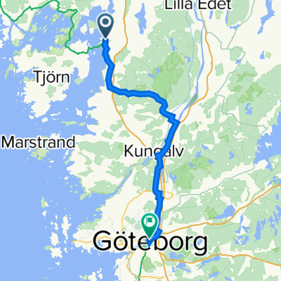 Kyrkvägen 28, Stenungsund nach Lilla Bommens torg 10, Göteborg
- Distance
- 57.8 km
- Ascent
- 239 m
- Descent
- 240 m
- Location
- Stenungsund, Västra Götaland County, Sweden
 Kuststigen Kolhättan-Uddevalla
- Distance
- 57 km
- Ascent
- 395 m
- Descent
- 422 m
- Location
- Stenungsund, Västra Götaland County, Sweden
 From Stenungsund to Uddevalla
- Distance
- 57.7 km
- Ascent
- 711 m
- Descent
- 711 m
- Location
- Stenungsund, Västra Götaland County, Sweden
 Stenungsund loop
- Distance
- 91.2 km
- Ascent
- 571 m
- Descent
- 586 m
- Location
- Stenungsund, Västra Götaland County, Sweden
 Stenungsund - Munkedal
- Distance
- 68.9 km
- Ascent
- 812 m
- Descent
- 804 m
- Location
- Stenungsund, Västra Götaland County, Sweden
Open it in the app