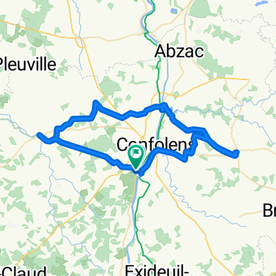
Confolens to Etagnac longer
A cycling route starting in Confolens, Nouvelle-Aquitaine, France.
Overview
About this route
- -:--
- Duration
- 76.8 km
- Distance
- 991 m
- Ascent
- 986 m
- Descent
- ---
- Avg. speed
- 287 m
- Max. altitude
Route quality
Waytypes & surfaces along the route
Waytypes
Road
46.1 km
(60 %)
Quiet road
26.1 km
(34 %)
Undefined
4.6 km
(6 %)
Surfaces
Paved
53.8 km
(70 %)
Asphalt
53 km
(69 %)
Paved (undefined)
0.8 km
(1 %)
Undefined
23.1 km
(30 %)
Continue with Bikemap
Use, edit, or download this cycling route
You would like to ride Confolens to Etagnac longer or customize it for your own trip? Here is what you can do with this Bikemap route:
Free features
- Save this route as favorite or in collections
- Copy & plan your own version of this route
- Sync your route with Garmin or Wahoo
Premium features
Free trial for 3 days, or one-time payment. More about Bikemap Premium.
- Navigate this route on iOS & Android
- Export a GPX / KML file of this route
- Create your custom printout (try it for free)
- Download this route for offline navigation
Discover more Premium features.
Get Bikemap PremiumFrom our community
Other popular routes starting in Confolens
Confolens to Etagnac- Distance
- 64.2 km
- Ascent
- 754 m
- Descent
- 751 m
- Location
- Confolens, Nouvelle-Aquitaine, France
Confolens to La Chabroulie, near Saint-Mathieu- Distance
- 55.2 km
- Ascent
- 519 m
- Descent
- 389 m
- Location
- Confolens, Nouvelle-Aquitaine, France
9 bis Rue Fontaine de Guimard, Confolens to 11 Rue Fontaine de Guimard, Confolens- Distance
- 61 km
- Ascent
- 1,018 m
- Descent
- 1,017 m
- Location
- Confolens, Nouvelle-Aquitaine, France
Confolens to Pressac- Distance
- 50.2 km
- Ascent
- 447 m
- Descent
- 455 m
- Location
- Confolens, Nouvelle-Aquitaine, France
De Confolens à D160, Pressignac- Distance
- 31.3 km
- Ascent
- 423 m
- Descent
- 335 m
- Location
- Confolens, Nouvelle-Aquitaine, France
Confolens to La Chapelle-Montbrandeix- Distance
- 55.5 km
- Ascent
- 584 m
- Descent
- 329 m
- Location
- Confolens, Nouvelle-Aquitaine, France
Confolens to Rochechouart- Distance
- 32.9 km
- Ascent
- 320 m
- Descent
- 221 m
- Location
- Confolens, Nouvelle-Aquitaine, France
Confolens to Etagnac longer- Distance
- 76.8 km
- Ascent
- 991 m
- Descent
- 986 m
- Location
- Confolens, Nouvelle-Aquitaine, France
Open it in the app


