

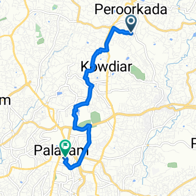
Aruvikkara-Karakulam
A cycling route starting in Thiruvananthapuram, Kerala, India.
Overview
About this route
- 1 h 2 min
- Duration
- 19.3 km
- Distance
- 335 m
- Ascent
- 306 m
- Descent
- 18.8 km/h
- Avg. speed
- 115 m
- Max. altitude

Route quality
Waytypes & surfaces along the route
Waytypes
Road
6.8 km
(35 %)
Quiet road
5.6 km
(29 %)
Undefined
7 km
(36 %)
Surfaces
Paved
7.2 km
(37 %)
Asphalt
6 km
(31 %)
Paved (undefined)
1.2 km
(6 %)
Undefined
12.2 km
(63 %)
Continue with Bikemap
Use, edit, or download this cycling route
You would like to ride Aruvikkara-Karakulam or customize it for your own trip? Here is what you can do with this Bikemap route:
Free features
- Save this route as favorite or in collections
- Copy & plan your own version of this route
- Sync your route with Garmin or Wahoo
Premium features
Free trial for 3 days, or one-time payment. More about Bikemap Premium.
- Navigate this route on iOS & Android
- Export a GPX / KML file of this route
- Create your custom printout (try it for free)
- Download this route for offline navigation
Discover more Premium features.
Get Bikemap PremiumFrom our community
Other popular routes starting in Thiruvananthapuram
 Kuravankonam - Nanthancode - Kowdiar
- Distance
- 6.3 km
- Ascent
- 58 m
- Descent
- 55 m
- Location
- Thiruvananthapuram, Kerala, India
 Kowdiar-Edapazhanji Cross Loop
- Distance
- 10.9 km
- Ascent
- 103 m
- Descent
- 100 m
- Location
- Thiruvananthapuram, Kerala, India
 Loop 2
- Distance
- 6.3 km
- Ascent
- 58 m
- Descent
- 59 m
- Location
- Thiruvananthapuram, Kerala, India
 Kowdiar - Ayiravalli River
- Distance
- 14.4 km
- Ascent
- 141 m
- Descent
- 150 m
- Location
- Thiruvananthapuram, Kerala, India
 Kowdiar to Madavoorpara
- Distance
- 16.4 km
- Ascent
- 188 m
- Descent
- 151 m
- Location
- Thiruvananthapuram, Kerala, India
 Kowdiar - Aruvikkara
- Distance
- 18.8 km
- Ascent
- 207 m
- Descent
- 204 m
- Location
- Thiruvananthapuram, Kerala, India
 Route to Shangumughom Beach
- Distance
- 11.9 km
- Ascent
- 23 m
- Descent
- 36 m
- Location
- Thiruvananthapuram, Kerala, India
 Route to University College of Thiruvanathapuram
- Distance
- 6.5 km
- Ascent
- 66 m
- Descent
- 70 m
- Location
- Thiruvananthapuram, Kerala, India
Open it in the app