

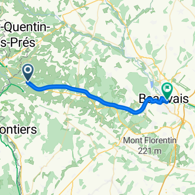
Stage 3-Gisors / St-Germer-de-Fly
A cycling route starting in Saint-Germer-de-Fly, Hauts-de-France, France.
Overview
About this route
Stage 3 - Gisors to St Germer-de-fly
- 1 h 51 min
- Duration
- 29.5 km
- Distance
- 223 m
- Ascent
- 252 m
- Descent
- 15.9 km/h
- Avg. speed
- 188 m
- Max. altitude

Route quality
Waytypes & surfaces along the route
Waytypes
Road
14.2 km
(48 %)
Quiet road
13.6 km
(46 %)
Undefined
1.8 km
(6 %)
Surfaces
Paved
26.3 km
(89 %)
Asphalt
26.3 km
(89 %)
Undefined
3.2 km
(11 %)
Continue with Bikemap
Use, edit, or download this cycling route
You would like to ride Stage 3-Gisors / St-Germer-de-Fly or customize it for your own trip? Here is what you can do with this Bikemap route:
Free features
- Save this route as favorite or in collections
- Copy & plan your own version of this route
- Sync your route with Garmin or Wahoo
Premium features
Free trial for 3 days, or one-time payment. More about Bikemap Premium.
- Navigate this route on iOS & Android
- Export a GPX / KML file of this route
- Create your custom printout (try it for free)
- Download this route for offline navigation
Discover more Premium features.
Get Bikemap PremiumFrom our community
Other popular routes starting in Saint-Germer-de-Fly
 Beauvais / St-Germer-de-Fly
- Distance
- 25.5 km
- Ascent
- 55 m
- Descent
- 90 m
- Location
- Saint-Germer-de-Fly, Hauts-de-France, France
 Stage 3-Gisors / St-Germer-de-Fly
- Distance
- 29.5 km
- Ascent
- 223 m
- Descent
- 252 m
- Location
- Saint-Germer-de-Fly, Hauts-de-France, France
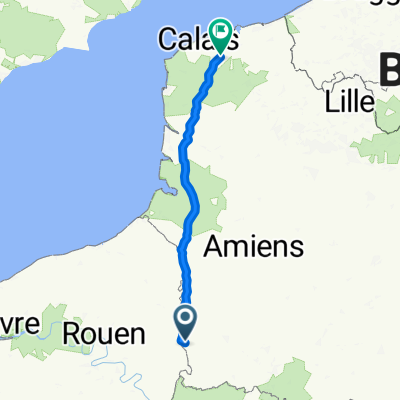 Rue de la Hayette 1, Saint-Pierre-es-Champs to Rue Monecove 45, Nortkerque
- Distance
- 190 km
- Ascent
- 1,677 m
- Descent
- 1,884 m
- Location
- Saint-Germer-de-Fly, Hauts-de-France, France
 Paris Teil 1 bis Cergy
- Distance
- 92.3 km
- Ascent
- 705 m
- Descent
- 768 m
- Location
- Saint-Germer-de-Fly, Hauts-de-France, France
 Jour 2 (2/2) : St-Germer-de-Fly / Forges-les-Eaux
- Distance
- 33.1 km
- Ascent
- 316 m
- Descent
- 253 m
- Location
- Saint-Germer-de-Fly, Hauts-de-France, France
 Into Paris Avenue Verte!
- Distance
- 136.4 km
- Ascent
- 910 m
- Descent
- 961 m
- Location
- Saint-Germer-de-Fly, Hauts-de-France, France
 De Rue des Solons 34, Cuigy-en-Bray à Rue des Solons 34, Cuigy-en-Bray
- Distance
- 61.2 km
- Ascent
- 25 m
- Descent
- 20 m
- Location
- Saint-Germer-de-Fly, Hauts-de-France, France
 Etape5-st-germer-de-fly-forges-les-eaux
- Distance
- 32.8 km
- Ascent
- 277 m
- Descent
- 207 m
- Location
- Saint-Germer-de-Fly, Hauts-de-France, France
Open it in the app