

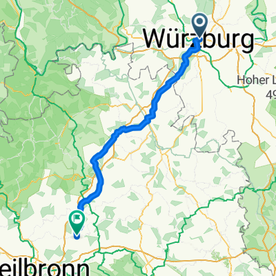
Würzburg Regensburg Tauber Altmühl
A cycling route starting in Wurzburg, Bavaria, Germany.
Overview
About this route
- -:--
- Duration
- 334.2 km
- Distance
- 2,307 m
- Ascent
- 2,158 m
- Descent
- ---
- Avg. speed
- 496 m
- Max. altitude

Route quality
Waytypes & surfaces along the route
Waytypes
Quiet road
95.4 km
(29 %)
Track
95.1 km
(28 %)
Surfaces
Paved
242.5 km
(73 %)
Unpaved
38.5 km
(12 %)
Asphalt
225.1 km
(67 %)
Gravel
24.5 km
(7 %)
Continue with Bikemap
Use, edit, or download this cycling route
You would like to ride Würzburg Regensburg Tauber Altmühl or customize it for your own trip? Here is what you can do with this Bikemap route:
Free features
- Save this route as favorite or in collections
- Copy & plan your own version of this route
- Split it into stages to create a multi-day tour
- Sync your route with Garmin or Wahoo
Premium features
Free trial for 3 days, or one-time payment. More about Bikemap Premium.
- Navigate this route on iOS & Android
- Export a GPX / KML file of this route
- Create your custom printout (try it for free)
- Download this route for offline navigation
Discover more Premium features.
Get Bikemap PremiumFrom our community
Other popular routes starting in Wurzburg
 Würzburg Kochersteinsfeld wie outdooractive - e Bike
- Distance
- 95.8 km
- Ascent
- 1,644 m
- Descent
- 1,635 m
- Location
- Wurzburg, Bavaria, Germany
 Würzburg Kochersteinsfeld wie outdooractive -ausgeglichen
- Distance
- 101.3 km
- Ascent
- 1,565 m
- Descent
- 1,556 m
- Location
- Wurzburg, Bavaria, Germany
 Rückermainstraße, Würzburg to Place de la Palud, Lausanne
- Distance
- 627.9 km
- Ascent
- 6,215 m
- Descent
- 5,892 m
- Location
- Wurzburg, Bavaria, Germany
 Steinbachtal-H'berg-Waldbüttelbrunn-H'berg-Steinbachtal
- Distance
- 16.9 km
- Ascent
- 239 m
- Descent
- 236 m
- Location
- Wurzburg, Bavaria, Germany
 Würzburg Kochersteinsfeld über Ochsenfurt -ausgeglichen
- Distance
- 121.1 km
- Ascent
- 1,430 m
- Descent
- 1,418 m
- Location
- Wurzburg, Bavaria, Germany
 1-Romantische Straße, Würzburg - Füssen, Teil 1 CLONED FROM ROUTE 181277
- Distance
- 105.7 km
- Ascent
- 476 m
- Descent
- 245 m
- Location
- Wurzburg, Bavaria, Germany
 Würzburg nach Rothenburg
- Distance
- 77.9 km
- Ascent
- 580 m
- Descent
- 342 m
- Location
- Wurzburg, Bavaria, Germany
 Runde Höhenweg Wü Richtung Och 12xxhm
- Distance
- 56.1 km
- Ascent
- 784 m
- Descent
- 784 m
- Location
- Wurzburg, Bavaria, Germany
Open it in the app