ETAPA 1
- 154.5 km
- 2,277 m
- 2,410 m
- Bonansa, Aragon, Spain
A cycling route starting in Bonansa, Aragon, Spain.
Overview
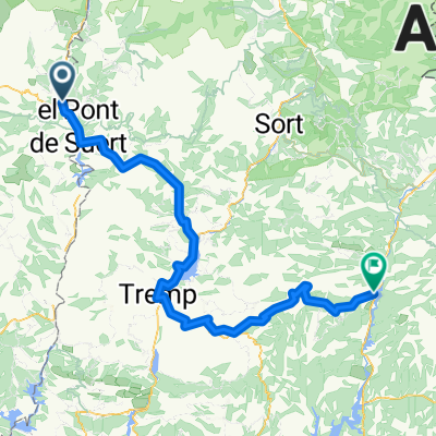
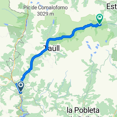
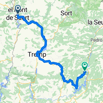
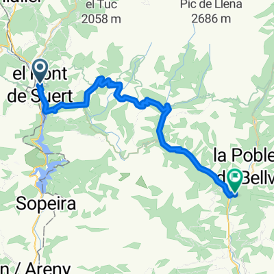
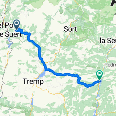
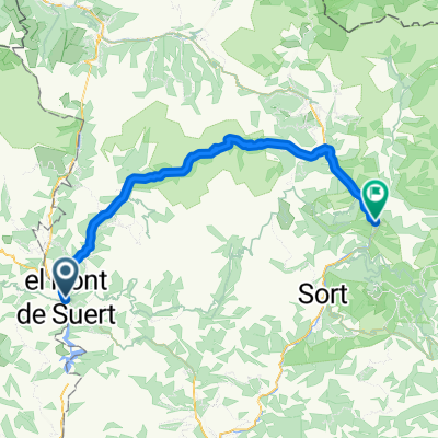
Unforgettable circular route through the oscense regions of Ribagorça and Sobrarbe. These are the most rugged areas of the Aragonese Pyrenees, making it an ideal place for outdoor activities. Our journey takes place around the Natural Park (since 1964) of Poçets-Maladeta, which hosts the highest number of peaks over 3000 meters in altitude, 13 glaciers, and the highest ski resort in the Pyrenees: Cerler. The lush nature and the purity of its rivers will be our travel companions. Whimsical geological formations will pleasantly surprise us. Waterfalls, rivers, mountain lakes, reservoirs, and springs everywhere quenching the thirst of the numerous livestock that graze peacefully on the slopes. Fairy-tale valleys such as Chistau, Benasque, or Ventimillo. Gorges difficult to access where humans have outdone themselves to conquer nature, such as the La Inclusa Gorge on the Cinqueta River, the Ventimillo Gorge on the Ésera, or the Las Devotas Gorge on the Cinca. Trails for all tastes and levels that make this route unique. The popular civil architecture with sturdy stone walls to fight off the cold temperatures is striking. An interior layout adapted to agriculture, livestock farming, and recently to winter tourism. Regarding gastronomy, one could speak at length, but it is best to try it yourself. We will travel along the courses of several important rivers of the Sobrarbe and Ribagorça regions such as the Ribera Ribagorçana, Cinca, Cinqueta, Ésera, Irués, or Chistau. Friendly people ready to help whenever you need it are what you will find in the urban centers. The sporting challenge with nearly 8000 meters of climbing and 230 kilometers will remind you that as humans we have physical limits to overcome. Only 81 bikers have completed the route I propose here, including myself. There is a more popular alternative (970 participants) where 35 km of technical trails are cut down and replaced by sections of tracks or roads. This means finishing the stages earlier, although the altitude gain and distance are similar. This alternative is called the Pirené Epic Trail. As for the one I present to you here, the Pirené Epic Trail Extrem, these are the data recorded by my GPS: Stage 1 ---> Pont de Suer-Senz(1) ---> 64 km ---> 2064 m climbing+ ---> IBP 150 Stage 2 ---> Senz-Plan (2) ---> 45 km ---> 1430 m climbing+ ---> IBP 110 Stage 3 ---> Plan-Castejón de Sos ---> 61 km ---> 2032 m climbing+ ---> IBP 147 Stage 4 ---> Castejón-Pont de Suer ---> 58 km ---> 2223 m climbing+ ---> IBP 179 Greetings and enjoy it.
created this 14 years ago
Continue with Bikemap
You would like to ride Piriné Epic Trail Extrem or customize it for your own trip? Here is what you can do with this Bikemap route:
Free trial for 3 days, or one-time payment. More about Bikemap Premium.
Discover more Premium features.
Get Bikemap PremiumFrom our community
Open it in the app