

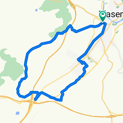
Plasencia - Cáceres por Via de la Plata
A cycling route starting in Plasencia, Extremadura, Spain.
Overview
About this route
Entre el tramo 21,5 y 22 pasamos por una finca en la que, a pesar de transcurrir cláramente la vía de la plata por ella (se ve la calzada romana) aparece un cartel de "Prohibido el paso, finca privada", haced caso omiso y pasad.
El tramo entre los kilometros 52 y 54 esta en obras por la construccion del AVE por lo que debemos prestar mucha atencion a las indicaciones provisionales que tengan puestas la empresa constructora.
Del Km 55 al 63 iniciamos el tramo de los puentes, este tramo está lleno de subidas y bajadas técnicas y pronunciadas, se puede tardar aproximadamente 1h en pasar, si quereis recortar tiempo o no estais sobrados de fuerzas podeis hacer estos kilómetros por la Carretera Nacional, no está apenas transitada y tiene arcén practicable.
- -:--
- Duration
- 87.2 km
- Distance
- 721 m
- Ascent
- 667 m
- Descent
- ---
- Avg. speed
- ---
- Max. altitude

Route quality
Waytypes & surfaces along the route
Waytypes
Track
46.3 km
(53 %)
Busy road
10.8 km
(12 %)
Surfaces
Paved
16.1 km
(19 %)
Unpaved
21 km
(24 %)
Asphalt
11.5 km
(13 %)
Gravel
9.6 km
(11 %)
Route highlights
Points of interest along the route
Point of interest after 21.9 km
Puerta. Coger el camino de la izquierda.
Point of interest after 22.5 km
Puerta. Inicio de tramo con cartel de Prohibido Pasar. Caso Omiso.
Point of interest after 22.8 km
Puerta
Point of interest after 23.1 km
Puerta. Fin del tramo en el aparece un cartel de Prohibido pasar.
Point of interest after 27.5 km
Puerta.
Point of interest after 38.3 km
2 puertas. Se cruza la carretera
Point of interest after 39.2 km
Point of interest after 41.8 km
Puerta
Point of interest after 44.4 km
Merendero
Point of interest after 53.2 km
Inicio tramo Obras Ave
Point of interest after 55.2 km
Fin Tramo Obras Ave
Point of interest after 57 km
Inicio Tramo Puentes. Ver Descripción
Point of interest after 64 km
Fin Tramo Puentes
Continue with Bikemap
Use, edit, or download this cycling route
You would like to ride Plasencia - Cáceres por Via de la Plata or customize it for your own trip? Here is what you can do with this Bikemap route:
Free features
- Save this route as favorite or in collections
- Copy & plan your own version of this route
- Split it into stages to create a multi-day tour
- Sync your route with Garmin or Wahoo
Premium features
Free trial for 3 days, or one-time payment. More about Bikemap Premium.
- Navigate this route on iOS & Android
- Export a GPX / KML file of this route
- Create your custom printout (try it for free)
- Download this route for offline navigation
Discover more Premium features.
Get Bikemap PremiumFrom our community
Other popular routes starting in Plasencia
 Ruta Perdiguera - Plasencia/Mirabel
- Distance
- 53 km
- Ascent
- 581 m
- Descent
- 576 m
- Location
- Plasencia, Extremadura, Spain
 2 Cáceres Salamanca
- Distance
- 100 km
- Ascent
- 1,229 m
- Descent
- 1,236 m
- Location
- Plasencia, Extremadura, Spain
 Gredos y Peña de Francia 2013
- Distance
- 621.8 km
- Ascent
- 3,763 m
- Descent
- 3,763 m
- Location
- Plasencia, Extremadura, Spain
 Vuelta al Merengue
- Distance
- 19.8 km
- Ascent
- 395 m
- Descent
- 390 m
- Location
- Plasencia, Extremadura, Spain
 Subida a la Ermita
- Distance
- 16.2 km
- Ascent
- 365 m
- Descent
- 369 m
- Location
- Plasencia, Extremadura, Spain
 Plasencia - Puerto Pitolero
- Distance
- 23.3 km
- Ascent
- 1,097 m
- Descent
- 178 m
- Location
- Plasencia, Extremadura, Spain
 Puertos del Valle
- Distance
- 215.3 km
- Ascent
- 4,617 m
- Descent
- 2,995 m
- Location
- Plasencia, Extremadura, Spain
 Plasencia - Embalse de Torrejón (Monfragüe)
- Distance
- 34 km
- Ascent
- 438 m
- Descent
- 539 m
- Location
- Plasencia, Extremadura, Spain
Open it in the app