

Chill..
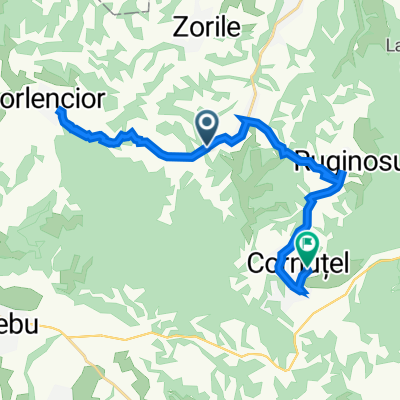
A cycling route starting in Cornuțel, Caraș-Severin County, Romania.
Overview
About this route
- 1 h 11 min
- Duration
- 6 km
- Distance
- 141 m
- Ascent
- 162 m
- Descent
- 5.1 km/h
- Avg. speed
- 327 m
- Max. altitude

Continue with Bikemap
Use, edit, or download this cycling route
You would like to ride Chill.. or customize it for your own trip? Here is what you can do with this Bikemap route:
Free features
- Save this route as favorite or in collections
- Copy & plan your own version of this route
- Sync your route with Garmin or Wahoo
Premium features
Free trial for 3 days, or one-time payment. More about Bikemap Premium.
- Navigate this route on iOS & Android
- Export a GPX / KML file of this route
- Create your custom printout (try it for free)
- Download this route for offline navigation
Discover more Premium features.
Get Bikemap PremiumFrom our community
Other popular routes starting in Cornuțel
 Chill..
- Distance
- 6 km
- Ascent
- 141 m
- Descent
- 162 m
- Location
- Cornuțel, Caraș-Severin County, Romania
 Drum fără nume, Cornuțel to Drum fără nume, Cornuțel
- Distance
- 4.3 km
- Ascent
- 279 m
- Descent
- 210 m
- Location
- Cornuțel, Caraș-Severin County, Romania
 DJ608B, Copacele to Cornutel, Paltinis
- Distance
- 22.2 km
- Ascent
- 447 m
- Descent
- 378 m
- Location
- Cornuțel, Caraș-Severin County, Romania
 Cornutel, Paltinis to Cornutel, Paltinis
- Distance
- 47.2 km
- Ascent
- 822 m
- Descent
- 823 m
- Location
- Cornuțel, Caraș-Severin County, Romania
 Chill ride
- Distance
- 28 km
- Ascent
- 753 m
- Descent
- 758 m
- Location
- Cornuțel, Caraș-Severin County, Romania
 Forest to road
- Distance
- 30.8 km
- Ascent
- 1,004 m
- Descent
- 985 m
- Location
- Cornuțel, Caraș-Severin County, Romania
 Recovered Route
- Distance
- 1.9 km
- Ascent
- 11 m
- Descent
- 52 m
- Location
- Cornuțel, Caraș-Severin County, Romania
 Cornuțel-Banat to Ruginosu
- Distance
- 14.7 km
- Ascent
- 508 m
- Descent
- 463 m
- Location
- Cornuțel, Caraș-Severin County, Romania
Open it in the app