

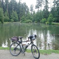
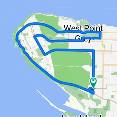
Richmond Loop for Emma
A cycling route starting in Vancouver, British Columbia, Canada.
Overview
About this route
- -:--
- Duration
- 42.9 km
- Distance
- 27 m
- Ascent
- 25 m
- Descent
- ---
- Avg. speed
- 7 m
- Max. altitude

Route quality
Waytypes & surfaces along the route
Waytypes
Road
14.6 km
(34 %)
Cycleway
14.2 km
(33 %)
Surfaces
Paved
27.1 km
(63 %)
Unpaved
9.9 km
(23 %)
Asphalt
21.9 km
(51 %)
Gravel
9.9 km
(23 %)
Continue with Bikemap
Use, edit, or download this cycling route
You would like to ride Richmond Loop for Emma or customize it for your own trip? Here is what you can do with this Bikemap route:
Free features
- Save this route as favorite or in collections
- Copy & plan your own version of this route
- Sync your route with Garmin or Wahoo
Premium features
Free trial for 3 days, or one-time payment. More about Bikemap Premium.
- Navigate this route on iOS & Android
- Export a GPX / KML file of this route
- Create your custom printout (try it for free)
- Download this route for offline navigation
Discover more Premium features.
Get Bikemap PremiumFrom our community
Other popular routes starting in Vancouver
 Long bike tour from Pastviny to Vancouver
- Distance
- 36.3 km
- Ascent
- 288 m
- Descent
- 238 m
- Location
- Vancouver, British Columbia, Canada
 UBC-Queen Elizabeth Park
- Distance
- 38.2 km
- Ascent
- 305 m
- Descent
- 306 m
- Location
- Vancouver, British Columbia, Canada
 VancouverUBC, Kits Beach ride
- Distance
- 28.8 km
- Ascent
- 223 m
- Descent
- 223 m
- Location
- Vancouver, British Columbia, Canada
 ride through Vancouver
- Distance
- 24.8 km
- Ascent
- 168 m
- Descent
- 168 m
- Location
- Vancouver, British Columbia, Canada
 Crown-UBC-4th Ave Hill circuit
- Distance
- 24.8 km
- Ascent
- 235 m
- Descent
- 236 m
- Location
- Vancouver, British Columbia, Canada
 Seawall
- Distance
- 20.4 km
- Ascent
- 473 m
- Descent
- 475 m
- Location
- Vancouver, British Columbia, Canada
 Barnet modified
- Distance
- 55.4 km
- Ascent
- 229 m
- Descent
- 231 m
- Location
- Vancouver, British Columbia, Canada
 WE, Vancouver to Cypress XC Area
- Distance
- 71.4 km
- Ascent
- 1,722 m
- Descent
- 1,723 m
- Location
- Vancouver, British Columbia, Canada
Open it in the app