

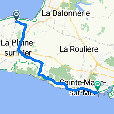
La Gobtrie 6, La Plaine-sur-Mer nach Rue Georges Clemenceau 72, Saint-Vincent-sur-Jard
A cycling route starting in La Plaine-sur-Mer, Pays de la Loire Region, France.
Overview
About this route
- 9 h 23 min
- Duration
- 145.6 km
- Distance
- 470 m
- Ascent
- 490 m
- Descent
- 15.5 km/h
- Avg. speed
- 40 m
- Max. altitude

Route quality
Waytypes & surfaces along the route
Waytypes
Quiet road
49.5 km
(34 %)
Cycleway
40.8 km
(28 %)
Surfaces
Paved
69.9 km
(48 %)
Unpaved
29.1 km
(20 %)
Asphalt
65.5 km
(45 %)
Gravel
27.7 km
(19 %)
Continue with Bikemap
Use, edit, or download this cycling route
You would like to ride La Gobtrie 6, La Plaine-sur-Mer nach Rue Georges Clemenceau 72, Saint-Vincent-sur-Jard or customize it for your own trip? Here is what you can do with this Bikemap route:
Free features
- Save this route as favorite or in collections
- Copy & plan your own version of this route
- Split it into stages to create a multi-day tour
- Sync your route with Garmin or Wahoo
Premium features
Free trial for 3 days, or one-time payment. More about Bikemap Premium.
- Navigate this route on iOS & Android
- Export a GPX / KML file of this route
- Create your custom printout (try it for free)
- Download this route for offline navigation
Discover more Premium features.
Get Bikemap PremiumFrom our community
Other popular routes starting in La Plaine-sur-Mer
 Pornic -Prefailles - Pte Saint Gildas
- Distance
- 35 km
- Ascent
- 135 m
- Descent
- 137 m
- Location
- La Plaine-sur-Mer, Pays de la Loire Region, France
 Jour 8 Pornic à Brem-sur-Mer
- Distance
- 112.2 km
- Ascent
- 295 m
- Descent
- 308 m
- Location
- La Plaine-sur-Mer, Pays de la Loire Region, France
 boucle PG-Préfailles-Pte St Gildas
- Distance
- 15.7 km
- Ascent
- 45 m
- Descent
- 44 m
- Location
- La Plaine-sur-Mer, Pays de la Loire Region, France
 De La Rouliere 16, Pornic à Rue des Hautes Rouches, Saint-Urbain
- Distance
- 45.2 km
- Ascent
- 114 m
- Descent
- 143 m
- Location
- La Plaine-sur-Mer, Pays de la Loire Region, France
 pornic
- Distance
- 10.8 km
- Ascent
- 220 m
- Descent
- 320 m
- Location
- La Plaine-sur-Mer, Pays de la Loire Region, France
 la Plaine - saint brevin les pins
- Distance
- 29.8 km
- Ascent
- 121 m
- Descent
- 122 m
- Location
- La Plaine-sur-Mer, Pays de la Loire Region, France
 Port Giraud - Paimboeuf
- Distance
- 64 km
- Ascent
- 165 m
- Descent
- 165 m
- Location
- La Plaine-sur-Mer, Pays de la Loire Region, France
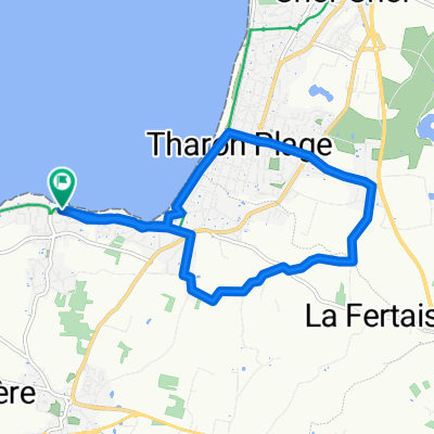 Petite Boucle P. Giraud-La Fertais-Tharon
- Distance
- 9.8 km
- Ascent
- 45 m
- Descent
- 43 m
- Location
- La Plaine-sur-Mer, Pays de la Loire Region, France
Open it in the app