

Gota Kanal 8a tappa: Askersund - Regna
A cycling route starting in Askersund, Örebro County, Sweden.
Overview
About this route
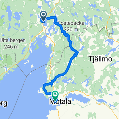
- Saturday, August 16, 2008 - 8th Stage:Askersund - Regna6th stage Giro Gota CanalCloudy weather in the morning then variableWe depart at 8:50 under a cloudy sky with a bit of fog. We retrace the bike path taken yesterday until Amme. We turn left onto the highway and follow it until Angermanland where we turn right towards Ronneshytta following the green sign of the Sverigeleden. In Ronneshytta, following the bike path, we turn left onto a dirt road. Now begins a long stretch of road through forests and lakes, passing the settlements of Galsjo, Svaldre, Narkesberg and Haddebo until we intersect with the national road 51. We turn left and after 1.5 km of the national road we turn right towards Bo. In Bo, we leave the Sverigeleden and turn right. After about 4 km we stop at a picnic area by Lake Avern (the sign indicates right 'Badplats') for the usual lunch. A brief drizzle lets us know that it is time to resume our journey and so at 1:50 PM we find ourselves at Regna Hotel Regnagarden under a nice sun.
- -:--
- Duration
- 64.8 km
- Distance
- 205 m
- Ascent
- 228 m
- Descent
- ---
- Avg. speed
- ---
- Max. altitude

Route quality
Waytypes & surfaces along the route
Waytypes
Road
53.2 km
(82 %)
Cycleway
5.8 km
(9 %)
Surfaces
Paved
38.9 km
(60 %)
Unpaved
25.9 km
(40 %)
Asphalt
38.9 km
(60 %)
Loose gravel
15.6 km
(24 %)
Continue with Bikemap
Use, edit, or download this cycling route
You would like to ride Gota Kanal 8a tappa: Askersund - Regna or customize it for your own trip? Here is what you can do with this Bikemap route:
Free features
- Save this route as favorite or in collections
- Copy & plan your own version of this route
- Sync your route with Garmin or Wahoo
Premium features
Free trial for 3 days, or one-time payment. More about Bikemap Premium.
- Navigate this route on iOS & Android
- Export a GPX / KML file of this route
- Create your custom printout (try it for free)
- Download this route for offline navigation
Discover more Premium features.
Get Bikemap PremiumFrom our community
Other popular routes starting in Askersund
 Gota Kanal 8a tappa: Askersund - Regna
- Distance
- 64.8 km
- Ascent
- 205 m
- Descent
- 228 m
- Location
- Askersund, Örebro County, Sweden
 Borensberg-Askersund
- Distance
- 89.3 km
- Ascent
- 358 m
- Descent
- 352 m
- Location
- Askersund, Örebro County, Sweden
 Floragatan 22, Askersund to Baggekärr 2, Tived
- Distance
- 51.8 km
- Ascent
- 812 m
- Descent
- 786 m
- Location
- Askersund, Örebro County, Sweden
 ostsee20-21 Askersund - Karlsborg
- Distance
- 61.3 km
- Ascent
- 392 m
- Descent
- 392 m
- Location
- Askersund, Örebro County, Sweden
 7 Askerssund 182
- Distance
- 155.9 km
- Ascent
- 1,340 m
- Descent
- 1,348 m
- Location
- Askersund, Örebro County, Sweden
 Askersund Malmo Airport
- Distance
- 884.2 km
- Ascent
- 542 m
- Descent
- 574 m
- Location
- Askersund, Örebro County, Sweden
 Runt Vättern 2011 6. Tag Askersund-Vadestena
- Distance
- 86.8 km
- Ascent
- 360 m
- Descent
- 360 m
- Location
- Askersund, Örebro County, Sweden
 Askersund bis Motala (Tagesetappe 5)
- Distance
- 70.5 km
- Ascent
- 1,897 m
- Descent
- 1,889 m
- Location
- Askersund, Örebro County, Sweden
Open it in the app