

Sisters to Smith rocks loop
A cycling route starting in Sisters, Oregon, United States.
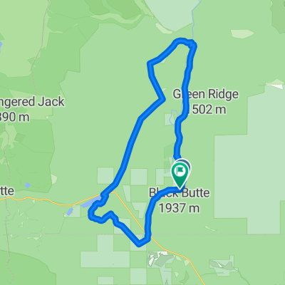
Overview
About this route
Sisters to Redmond Loop
- -:--
- Duration
- 74.1 km
- Distance
- 451 m
- Ascent
- 483 m
- Descent
- ---
- Avg. speed
- 973 m
- Max. altitude
John Peebles
created this 2 years ago
Route quality
Waytypes & surfaces along the route
Waytypes
Road
20.7 km
28 %
Cycleway
20.7 km
28 %
Surfaces
Paved
34.8 km
(47 %)
Unpaved
0.7 km
(1 %)
Asphalt
34.8 km
47 %
Gravel
0.7 km
1 %
Undefined
38.5 km
52 %
Continue with Bikemap
Use, edit, or download this cycling route
You would like to ride Sisters to Smith rocks loop or customize it for your own trip? Here is what you can do with this Bikemap route:
Free features
- Save this route as favorite or in collections
- Copy & plan your own version of this route
- Sync your route with Garmin or Wahoo
Premium features
Free trial for 3 days, or one-time payment. More about Bikemap Premium.
- Navigate this route on iOS & Android
- Export a GPX / KML file of this route
- Create your custom printout (try it for free)
- Download this route for offline navigation
Discover more Premium features.
Get Bikemap PremiumFrom our community
Other popular routes starting in Sisters
- Black Butte, Camp Sherman, Suttle Lake
- 51.7 km
- 535 m
- 530 m
- Sisters, Oregon, United States
- 13436 Galium, Sisters to 13436 Galium, Sisters
- 9.3 km
- 134 m
- 128 m
- Sisters, Oregon, United States
- music to the train
- 161.8 km
- 1,173 m
- 694 m
- Sisters, Oregon, United States
- 13438–13476 Galium, Sisters to 13436 Galium, Sisters
- 5.9 km
- 134 m
- 127 m
- Sisters, Oregon, United States
- South Locust Street 889, Sisters to South Fir Street 350, Sisters
- 10.1 km
- 164 m
- 168 m
- Sisters, Oregon, United States
- Sisters, Black Butte, Suttle Lake
- 58.6 km
- 550 m
- 550 m
- Sisters, Oregon, United States
- 525 E Cascade Ave, Sisters to 91904–91930 Taylor Rd, McKenzie Bridge
- 67.3 km
- 650 m
- 1,190 m
- Sisters, Oregon, United States


Open it in the app