

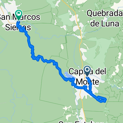
San Marcos Sierras - Ambul
A cycling route starting in Capilla del Monte, Cordoba Province, Argentina.
Overview
About this route
Trip made in November 2009 from San Marcos Sierras to Ambul, overnighting in La Candelaria with a support Berlingo and taking turns driving it every 15 km.
- -:--
- Duration
- 153.4 km
- Distance
- 1,946 m
- Ascent
- 1,478 m
- Descent
- ---
- Avg. speed
- ---
- Max. altitude

Route highlights
Points of interest along the route

Point of interest after 0.5 km
Plaza de San Marcos

Point of interest after 21.8 km
Camino a Pinto

Point of interest after 36.1 km
Rio Pinto

Point of interest after 43.1 km
Pampa de Olaen

Point of interest after 51.4 km
Pamapa de olaen

Point of interest after 69.8 km
Capilla Abandonada

Point of interest after 71.5 km
Canteras Iguazu

Point of interest after 86.3 km
La Candelaria Estancia Jesuitica

Point of interest after 100.8 km
Majada de Santiago

Point of interest after 110.1 km
Cruce con el camino de Los Gigantes
Continue with Bikemap
Use, edit, or download this cycling route
You would like to ride San Marcos Sierras - Ambul or customize it for your own trip? Here is what you can do with this Bikemap route:
Free features
- Save this route as favorite or in collections
- Copy & plan your own version of this route
- Split it into stages to create a multi-day tour
- Sync your route with Garmin or Wahoo
Premium features
Free trial for 3 days, or one-time payment. More about Bikemap Premium.
- Navigate this route on iOS & Android
- Export a GPX / KML file of this route
- Create your custom printout (try it for free)
- Download this route for offline navigation
Discover more Premium features.
Get Bikemap PremiumFrom our community
Other popular routes starting in Capilla del Monte
 Revancha Rio Pinto 2012
- Distance
- 71.1 km
- Ascent
- 862 m
- Descent
- 358 m
- Location
- Capilla del Monte, Cordoba Province, Argentina
 San Marcos Sierra - Capilla del Monte - Cerro Las Gemelas
- Distance
- 36.3 km
- Ascent
- 496 m
- Descent
- 839 m
- Location
- Capilla del Monte, Cordoba Province, Argentina
 San Marcos - La Cumbre
- Distance
- 40.2 km
- Ascent
- 711 m
- Descent
- 232 m
- Location
- Capilla del Monte, Cordoba Province, Argentina
 San Marcos Sierras - Ambul
- Distance
- 153.4 km
- Ascent
- 1,946 m
- Descent
- 1,478 m
- Location
- Capilla del Monte, Cordoba Province, Argentina
 Capilla del Monte - San Marcos Sierra
- Distance
- 24.1 km
- Ascent
- 334 m
- Descent
- 681 m
- Location
- Capilla del Monte, Cordoba Province, Argentina
 Vuelta sierras de comechingones
- Distance
- 140.7 km
- Ascent
- 2,983 m
- Descent
- 2,984 m
- Location
- Capilla del Monte, Cordoba Province, Argentina
 Dique los Alazanes
- Distance
- 10.1 km
- Ascent
- 670 m
- Descent
- 531 m
- Location
- Capilla del Monte, Cordoba Province, Argentina
 uritorco
- Distance
- 5 km
- Ascent
- 950 m
- Descent
- 92 m
- Location
- Capilla del Monte, Cordoba Province, Argentina
Open it in the app