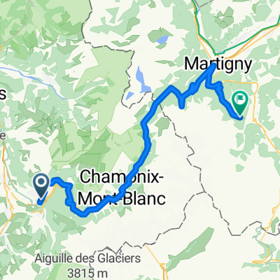
ALTO DE PLAINE-JOUX
A cycling route starting in Passy, Auvergne-Rh么ne-Alpes, France.
Overview
About this route
- -:--
- Duration
- 16 km
- Distance
- 845 m
- Ascent
- 69 m
- Descent
- ---
- Avg. speed
- 1,355 m
- Max. altitude
Route quality
Waytypes & surfaces along the route
Waytypes
Road
13.6 km
(85 %)
Path
0.8 km
(5 %)
Surfaces
Paved
15.4 km
(96 %)
Unpaved
0.3 km
(2 %)
Asphalt
15.4 km
(96 %)
Ground
0.3 km
(2 %)
Undefined
0.3 km
(2 %)
Continue with Bikemap
Use, edit, or download this cycling route
You would like to ride ALTO DE PLAINE-JOUX or customize it for your own trip? Here is what you can do with this Bikemap route:
Free features
- Save this route as favorite or in collections
- Copy & plan your own version of this route
- Sync your route with Garmin or Wahoo
Premium features
Free trial for 3 days, or one-time payment. More about Bikemap Premium.
- Navigate this route on iOS & Android
- Export a GPX / KML file of this route
- Create your custom printout (try it for free)
- Download this route for offline navigation
Discover more Premium features.
Get Bikemap PremiumFrom our community
Other popular routes starting in Passy
De Route de Plaine Joux, Passy 脿 All茅e des Aiguilles, Chamonix-Mont-Blanc- Distance
- 38.4 km
- Ascent
- 867 m
- Descent
- 1,005 m
- Location
- Passy, Auvergne-Rh么ne-Alpes, France
Passy-chamonix- Distance
- 26.7 km
- Ascent
- 912 m
- Descent
- 437 m
- Location
- Passy, Auvergne-Rh么ne-Alpes, France
Passy - Reserve de Passy- Distance
- 19.5 km
- Ascent
- 1,399 m
- Descent
- 111 m
- Location
- Passy, Auvergne-Rh么ne-Alpes, France
Passy 2012- Distance
- 103.6 km
- Ascent
- 1,992 m
- Descent
- 1,987 m
- Location
- Passy, Auvergne-Rh么ne-Alpes, France
De Avenue L茅man Mont-Blanc 170, Passy 脿 Hameau des Fiz 140, Passy- Distance
- 54.2 km
- Ascent
- 519 m
- Descent
- 522 m
- Location
- Passy, Auvergne-Rh么ne-Alpes, France
Passy - Chamonix- Distance
- 25.4 km
- Ascent
- 670 m
- Descent
- 328 m
- Location
- Passy, Auvergne-Rh么ne-Alpes, France
Passy - Aravis - Passy- Distance
- 103.4 km
- Ascent
- 2,628 m
- Descent
- 2,649 m
- Location
- Passy, Auvergne-Rh么ne-Alpes, France
St. Gervais-Champex Lac- Distance
- 81.2 km
- Ascent
- 2,389 m
- Descent
- 1,495 m
- Location
- Passy, Auvergne-Rh么ne-Alpes, France
Open it in the app


