

Jammu to Patni Top Day0
A cycling route starting in Jammu, Jammu and Kashmir, India.
Overview
About this route
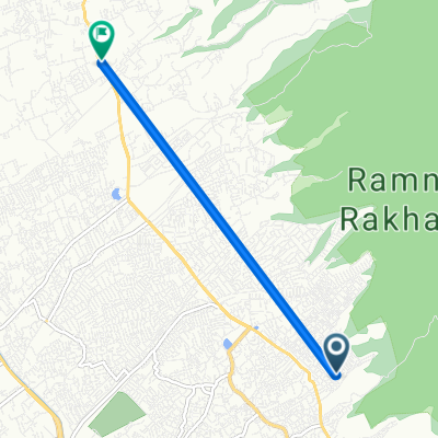
Day 0. From Jammu to Patni Top. Late afternoon Start, End by Night.
- -:--
- Duration
- 124.5 km
- Distance
- 2,157 m
- Ascent
- 977 m
- Descent
- ---
- Avg. speed
- ---
- Max. altitude
Continue with Bikemap
Use, edit, or download this cycling route
You would like to ride Jammu to Patni Top Day0 or customize it for your own trip? Here is what you can do with this Bikemap route:
Free features
- Save this route as favorite or in collections
- Copy & plan your own version of this route
- Split it into stages to create a multi-day tour
- Sync your route with Garmin or Wahoo
Premium features
Free trial for 3 days, or one-time payment. More about Bikemap Premium.
- Navigate this route on iOS & Android
- Export a GPX / KML file of this route
- Create your custom printout (try it for free)
- Download this route for offline navigation
Discover more Premium features.
Get Bikemap PremiumFrom our community
Other popular routes starting in Jammu
 Jammu to Patni Top Day0
- Distance
- 124.5 km
- Ascent
- 2,157 m
- Descent
- 977 m
- Location
- Jammu, Jammu and Kashmir, India
 Jammu to National Highway 144A, Dhar Dhrochan
- Distance
- 9.8 km
- Ascent
- 112 m
- Descent
- 96 m
- Location
- Jammu, Jammu and Kashmir, India
 Green Belt Road Pancmukhi Air Gaite, Jammu to Green Belt Road Pancmukhi Air Gaite, Jammu
- Distance
- 7.6 km
- Ascent
- 40 m
- Descent
- 37 m
- Location
- Jammu, Jammu and Kashmir, India
 MVG3+QF5, Jammu to MVG3+QF5, Jammu
- Distance
- 4.6 km
- Ascent
- 29 m
- Descent
- 36 m
- Location
- Jammu, Jammu and Kashmir, India
 Unnamed Road, Jammu to Unnamed Road, Jammu
- Distance
- 3.9 km
- Ascent
- 69 m
- Descent
- 51 m
- Location
- Jammu, Jammu and Kashmir, India
 Daily Excelsior Lane, Jammu to Bantalab Road, Jammu
- Distance
- 4.9 km
- Ascent
- 0 m
- Descent
- 0 m
- Location
- Jammu, Jammu and Kashmir, India
 7 April
- Distance
- 6.6 km
- Ascent
- 103 m
- Descent
- 101 m
- Location
- Jammu, Jammu and Kashmir, India
 Easy ride in
- Distance
- 38.8 km
- Ascent
- 392 m
- Descent
- 392 m
- Location
- Jammu, Jammu and Kashmir, India
Open it in the app