

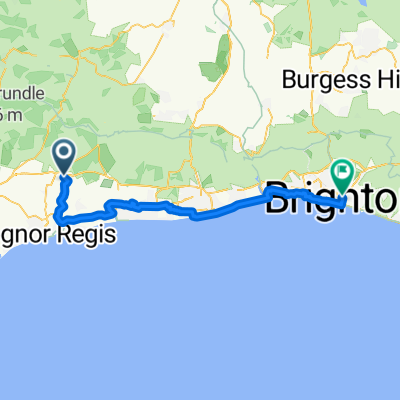
Slindon Woods Car Park 26er
A cycling route starting in Fontwell, England, United Kingdom.
Overview
About this route
Staring at Slindon Woods Car Park. Easy 26er cutting out the Charlton Climb.
- -:--
- Duration
- 26 km
- Distance
- 249 m
- Ascent
- 249 m
- Descent
- ---
- Avg. speed
- ---
- Max. altitude

Route quality
Waytypes & surfaces along the route
Waytypes
Road
17.1 km
(66 %)
Quiet road
5.5 km
(21 %)
Surfaces
Paved
11.7 km
(45 %)
Asphalt
10.9 km
(42 %)
Paved (undefined)
0.8 km
(3 %)
Undefined
14.3 km
(55 %)
Continue with Bikemap
Use, edit, or download this cycling route
You would like to ride Slindon Woods Car Park 26er or customize it for your own trip? Here is what you can do with this Bikemap route:
Free features
- Save this route as favorite or in collections
- Copy & plan your own version of this route
- Sync your route with Garmin or Wahoo
Premium features
Free trial for 3 days, or one-time payment. More about Bikemap Premium.
- Navigate this route on iOS & Android
- Export a GPX / KML file of this route
- Create your custom printout (try it for free)
- Download this route for offline navigation
Discover more Premium features.
Get Bikemap PremiumFrom our community
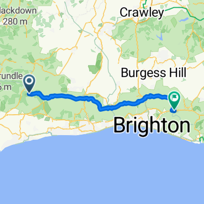
Other popular routes starting in Fontwell
 Slindon Woods Car Park 26er
- Distance
- 26 km
- Ascent
- 249 m
- Descent
- 249 m
- Location
- Fontwell, England, United Kingdom
 Wiggle Fallen Leaves MTB
- Distance
- 50.8 km
- Ascent
- 707 m
- Descent
- 708 m
- Location
- Fontwell, England, United Kingdom
 West Walberton Lane, Arundel to Queen's Road, Brighton
- Distance
- 53.1 km
- Ascent
- 111 m
- Descent
- 86 m
- Location
- Fontwell, England, United Kingdom
 Wiggle MTB Epic
- Distance
- 64 km
- Ascent
- 1,022 m
- Descent
- 1,027 m
- Location
- Fontwell, England, United Kingdom
 Slindon - Arundel - Bury - Bignor - Upwaltham - Eartham - Slindon Circuit
- Distance
- 55.9 km
- Ascent
- 861 m
- Descent
- 862 m
- Location
- Fontwell, England, United Kingdom
 Fontwell - Lewes
- Distance
- 54.4 km
- Ascent
- 839 m
- Descent
- 1,007 m
- Location
- Fontwell, England, United Kingdom
 Charlton Climb - New barn Hill 22er Loop
- Distance
- 21.7 km
- Ascent
- 274 m
- Descent
- 273 m
- Location
- Fontwell, England, United Kingdom
 1.hr Loop
- Distance
- 18.8 km
- Ascent
- 299 m
- Descent
- 300 m
- Location
- Fontwell, England, United Kingdom
Open it in the app