

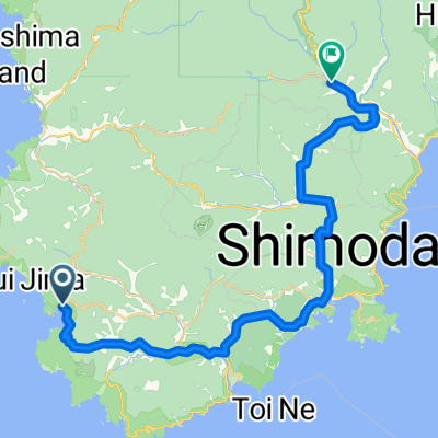
南伊豆-下田
A cycling route starting in Shimoda, Shizuoka, Japan.
Overview
About this route
- -:--
- Duration
- 69.7 km
- Distance
- 1,981 m
- Ascent
- 1,981 m
- Descent
- ---
- Avg. speed
- 217 m
- Max. altitude
Route quality
Waytypes & surfaces along the route
Waytypes
Quiet road
24.4 km
(35 %)
Cycleway
9.1 km
(13 %)
Surfaces
Paved
9.8 km
(14 %)
Paved (undefined)
9.1 km
(13 %)
Asphalt
0.7 km
(1 %)
Undefined
59.9 km
(86 %)
Continue with Bikemap
Use, edit, or download this cycling route
You would like to ride 南伊豆-下田 or customize it for your own trip? Here is what you can do with this Bikemap route:
Free features
- Save this route as favorite or in collections
- Copy & plan your own version of this route
- Sync your route with Garmin or Wahoo
Premium features
Free trial for 3 days, or one-time payment. More about Bikemap Premium.
- Navigate this route on iOS & Android
- Export a GPX / KML file of this route
- Create your custom printout (try it for free)
- Download this route for offline navigation
Discover more Premium features.
Get Bikemap PremiumFrom our community
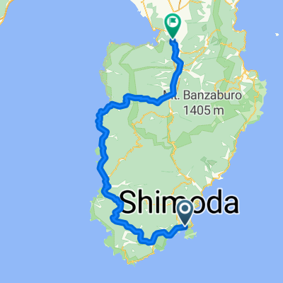
Other popular routes starting in Shimoda
 東伊豆コース
- Distance
- 73.5 km
- Ascent
- 1,987 m
- Descent
- 1,944 m
- Location
- Shimoda, Shizuoka, Japan
 Amagi start?
- Distance
- 14.5 km
- Ascent
- 1,101 m
- Descent
- 658 m
- Location
- Shimoda, Shizuoka, Japan
 天城越えルート
- Distance
- 53 km
- Ascent
- 1,554 m
- Descent
- 1,522 m
- Location
- Shimoda, Shizuoka, Japan
 子浦到湯ヶ野41公里
- Distance
- 41 km
- Ascent
- 633 m
- Descent
- 552 m
- Location
- Shimoda, Shizuoka, Japan
 河津/旅師の宿 やかた-南伊豆一周
- Distance
- 120.4 km
- Ascent
- 1,371 m
- Descent
- 1,380 m
- Location
- Shimoda, Shizuoka, Japan
 下田到沼津
下田到沼津- Distance
- 73.9 km
- Ascent
- 1,005 m
- Descent
- 993 m
- Location
- Shimoda, Shizuoka, Japan
 湯ヶ野新天城隧道到三島48.8公里
- Distance
- 48.9 km
- Ascent
- 777 m
- Descent
- 839 m
- Location
- Shimoda, Shizuoka, Japan
 Day 2從Shimoda Ocean Park Hotel到石のや 伊豆長岡的路線
- Distance
- 89.8 km
- Ascent
- 1,308 m
- Descent
- 1,289 m
- Location
- Shimoda, Shizuoka, Japan
Open it in the app