

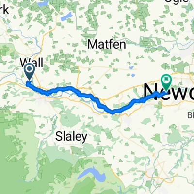
010 Chollerford naar Ferry
A cycling route starting in Wall, England, United Kingdom.
Overview
About this route
- -:--
- Duration
- 50.7 km
- Distance
- 516 m
- Ascent
- 563 m
- Descent
- ---
- Avg. speed
- 275 m
- Max. altitude

Route quality
Waytypes & surfaces along the route
Waytypes
Busy road
17.7 km
(35 %)
Cycleway
17.5 km
(34 %)
Surfaces
Paved
38.9 km
(77 %)
Unpaved
1 km
(2 %)
Asphalt
34.5 km
(68 %)
Paving stones
2.4 km
(5 %)
Continue with Bikemap
Use, edit, or download this cycling route
You would like to ride 010 Chollerford naar Ferry or customize it for your own trip? Here is what you can do with this Bikemap route:
Free features
- Save this route as favorite or in collections
- Copy & plan your own version of this route
- Sync your route with Garmin or Wahoo
Premium features
Free trial for 3 days, or one-time payment. More about Bikemap Premium.
- Navigate this route on iOS & Android
- Export a GPX / KML file of this route
- Create your custom printout (try it for free)
- Download this route for offline navigation
Discover more Premium features.
Get Bikemap PremiumFrom our community
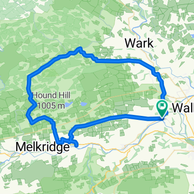
Other popular routes starting in Wall
 Humshaugh (Haughton Castle) to N end of Erewash Trail
- Distance
- 299.2 km
- Ascent
- 1,039 m
- Descent
- 1,054 m
- Location
- Wall, England, United Kingdom
 Hadrian's Wall and Route suggestions
- Distance
- 773.6 km
- Ascent
- 158 m
- Descent
- 229 m
- Location
- Wall, England, United Kingdom
 Homer's Lane to The Square 2, Humshaugh
- Distance
- 11.5 km
- Ascent
- 150 m
- Descent
- 95 m
- Location
- Wall, England, United Kingdom
 ryal bank
- Distance
- 47.4 km
- Ascent
- 376 m
- Descent
- 377 m
- Location
- Wall, England, United Kingdom
 010 Chollerford naar Ferry
- Distance
- 50.7 km
- Ascent
- 516 m
- Descent
- 563 m
- Location
- Wall, England, United Kingdom
 wylam
wylam- Distance
- 26.6 km
- Ascent
- 107 m
- Descent
- 150 m
- Location
- Wall, England, United Kingdom
 Fourstones_stonehaugh_twice Brewed
- Distance
- 55.4 km
- Ascent
- 620 m
- Descent
- 620 m
- Location
- Wall, England, United Kingdom
 westall
- Distance
- 41.3 km
- Ascent
- 586 m
- Descent
- 580 m
- Location
- Wall, England, United Kingdom
Open it in the app