

2023-08-26
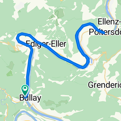
A cycling route starting in Alf, Rhineland-Palatinate, Germany.
Overview
About this route
- -:--
- Duration
- 87.7 km
- Distance
- 620 m
- Ascent
- 657 m
- Descent
- ---
- Avg. speed
- 117 m
- Max. altitude

Route quality
Waytypes & surfaces along the route
Waytypes
Busy road
34.9 km
(40 %)
Path
19 km
(22 %)
Surfaces
Paved
81.6 km
(93 %)
Unpaved
1.3 km
(1 %)
Asphalt
73.2 km
(83 %)
Paving stones
6.9 km
(8 %)
Continue with Bikemap
Use, edit, or download this cycling route
You would like to ride 2023-08-26 or customize it for your own trip? Here is what you can do with this Bikemap route:
Free features
- Save this route as favorite or in collections
- Copy & plan your own version of this route
- Split it into stages to create a multi-day tour
- Sync your route with Garmin or Wahoo
Premium features
Free trial for 3 days, or one-time payment. More about Bikemap Premium.
- Navigate this route on iOS & Android
- Export a GPX / KML file of this route
- Create your custom printout (try it for free)
- Download this route for offline navigation
Discover more Premium features.
Get Bikemap PremiumFrom our community
Other popular routes starting in Alf
 56841 Traben-Trarbach, Deutschland
- Distance
- 68.6 km
- Ascent
- 575 m
- Descent
- 573 m
- Location
- Alf, Rhineland-Palatinate, Germany
 Bullay - Bretzenheim
- Distance
- 85.3 km
- Ascent
- 1,395 m
- Descent
- 1,406 m
- Location
- Alf, Rhineland-Palatinate, Germany
 Bullay-Trier
- Distance
- 106.1 km
- Ascent
- 168 m
- Descent
- 131 m
- Location
- Alf, Rhineland-Palatinate, Germany
 190828_Alf_Piesport
- Distance
- 58.2 km
- Ascent
- 127 m
- Descent
- 90 m
- Location
- Alf, Rhineland-Palatinate, Germany
 Bully-Koblenz
- Distance
- 81.5 km
- Ascent
- 162 m
- Descent
- 192 m
- Location
- Alf, Rhineland-Palatinate, Germany
 Entspannende Route in Alf
- Distance
- 39.8 km
- Ascent
- 43 m
- Descent
- 116 m
- Location
- Alf, Rhineland-Palatinate, Germany
 Mosel - von Bullay nach Benkastel Kues
- Distance
- 47.8 km
- Ascent
- 149 m
- Descent
- 152 m
- Location
- Alf, Rhineland-Palatinate, Germany
 Gerade Fahrt in Alf an der Mosel
- Distance
- 33.4 km
- Ascent
- 356 m
- Descent
- 356 m
- Location
- Alf, Rhineland-Palatinate, Germany
Open it in the app