

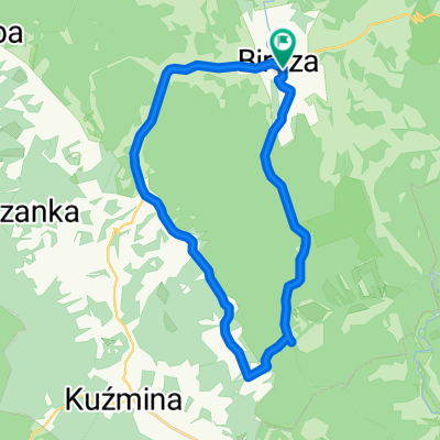
Bircza - južny okruh
- 21.7 km
- 298 m
- 298 m
- Bircza, Subcarpathian Voivodeship, Poland
A cycling route starting in Bircza, Subcarpathian Voivodeship, Poland.
Overview
Day 2 Tuesday 05.07.2011
Distance 124.5 km Time 7.11 hours Average speed 17.3 km/h Maximum speed 62.79 km/h
It drizzled a bit in the morning. When I started (around 8:00) the sun was shining, and later it was like a Bollywood movie: 'Sometimes sun, sometimes rain'. A bit of putting on clothes, taking off clothes, and running from the rain.
Two or three rainy stops at PKS bus stops where I enjoyed tea and other treats from packets and more.
Two losses: a melted cup lid and worse, a small white-red flag that was supposed to accompany me along the whole route.
On the route, I met two touring cyclists with panniers and one motorcyclist who thought I was German.
Several beautiful places, entrance to Bieszczady National Park, viewpoints in Lutowiska, rides along and across the San and Wołosaty rivers, views of the Bieszczady when clouds revealed them.
Several picturesque Orthodox churches.
Serious switchbacks started, but greetings from people passing by gave me strength.
At the end of the day, escaping another rain, I ended up in Wetlina at a pub called 'Napełniamy brzuszki'.
Very nice atmosphere and good food, tripe finger-licking good.
After warming up and talking with a tourist couple from Lublin, I set off again.
The tourists recommended accommodation 'U Rumcajsa', but since it wasn't raining, I decided to continue.
And that was a mistake—after leaving Wetlina it started pouring. I didn't know whether to stop under a tree (no stop available) or keep going.
I chose the second option.
Completely soaked and cold, I found accommodation in Strzebowiska.
An additional plus was the possibility to order two beers (Wingdings symbol J).
Only the weather forecast for the next day: 15 degrees and rain.
I'll probably wrap myself entirely in foil ;) Because T.B.T. and J. (you have to be tough and ride).
Oh, another trick with the bike computer: when I turned it display down and didn't watch how slowly the kilometers were adding up, it felt better to ride.
Music theme of the day: 'Go west' by Pet Shop Boys.
created this 14 years ago
Route quality
Road
2.4 km
2 %
Quiet road
2.4 km
2 %
Paved
115.2 km
(96 %)
Unpaved
1.2 km
(1 %)
Asphalt
115.2 km
96 %
Ground
1.2 km
1 %
Undefined
3.6 km
3 %
Route highlights
Postój Zakupy i szamanko.
Nazwy miasteczek i wsi, czasem zabawne a czasem kojarzące się z jakąś osobą . Tu z kolegą z tenisowej drużyny Jurkiem K.
Kolejny deszczowy postój. Myślałem o odwiedzeniu Ukrainy ale bez paszportu to niemożliwe.
Pierwsze "naj" Najbardziej wysunięty na południe Polski punkt mjej trasy.
Jedzonko "Napełniłem brzuszek"
Nocleg
Continue with Bikemap
You would like to ride Dookoła Polski 2 dzień(Nowa Wieś-Strzebowiska) or customize it for your own trip? Here is what you can do with this Bikemap route:
Free trial for 3 days, or one-time payment. More about Bikemap Premium.
Discover more Premium features.
Get Bikemap PremiumFrom our community
Open it in the app


