

Alphaville - Trilha Monte Carlo
A cycling route starting in Carapicuíba, São Paulo, Brazil.
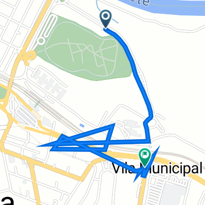
Overview
About this route
- -:--
- Duration
- 12.3 km
- Distance
- 333 m
- Ascent
- 333 m
- Descent
- ---
- Avg. speed
- ---
- Max. altitude

Continue with Bikemap
Use, edit, or download this cycling route
You would like to ride Alphaville - Trilha Monte Carlo or customize it for your own trip? Here is what you can do with this Bikemap route:
Free features
- Save this route as favorite or in collections
- Copy & plan your own version of this route
- Sync your route with Garmin or Wahoo
Premium features
Free trial for 3 days, or one-time payment. More about Bikemap Premium.
- Navigate this route on iOS & Android
- Export a GPX / KML file of this route
- Create your custom printout (try it for free)
- Download this route for offline navigation
Discover more Premium features.
Get Bikemap PremiumFrom our community
Other popular routes starting in Carapicuíba
 Alphaville - Trilha Salve Jorge
- Distance
- 4 km
- Ascent
- 285 m
- Descent
- 285 m
- Location
- Carapicuíba, São Paulo, Brazil
 1º Percurso
- Distance
- 8.4 km
- Ascent
- 168 m
- Descent
- 181 m
- Location
- Carapicuíba, São Paulo, Brazil
 Casa - Aldeia
- Distance
- 48.1 km
- Ascent
- 794 m
- Descent
- 795 m
- Location
- Carapicuíba, São Paulo, Brazil
 até o allianz
- Distance
- 68.9 km
- Ascent
- 860 m
- Descent
- 855 m
- Location
- Carapicuíba, São Paulo, Brazil
 Rota treino Alphaville
- Distance
- 22.8 km
- Ascent
- 461 m
- Descent
- 461 m
- Location
- Carapicuíba, São Paulo, Brazil
 Rota para Avenida Brasil 204F
- Distance
- 2.7 km
- Ascent
- 3 m
- Descent
- 15 m
- Location
- Carapicuíba, São Paulo, Brazil
 Tour Carapicuiba- Barueri - Santana de Parnaiba
- Distance
- 33.5 km
- Ascent
- 439 m
- Descent
- 446 m
- Location
- Carapicuíba, São Paulo, Brazil
 De Rua Pinho Branco 36 a Estrada das Acácias 24
- Distance
- 8.2 km
- Ascent
- 166 m
- Descent
- 932 m
- Location
- Carapicuíba, São Paulo, Brazil
Open it in the app