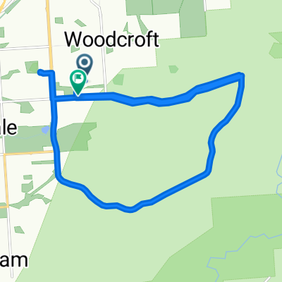
bit of fun
A cycling route starting in Reynella, South Australia, Australia.
Overview
About this route
- -:--
- Duration
- 19 km
- Distance
- 82 m
- Ascent
- 196 m
- Descent
- ---
- Avg. speed
- ---
- Max. altitude
Route quality
Waytypes & surfaces along the route
Waytypes
Road
8.4 km
(44 %)
Cycleway
3.6 km
(19 %)
Surfaces
Paved
13 km
(68 %)
Unpaved
0.2 km
(1 %)
Asphalt
12.6 km
(66 %)
Paved (undefined)
0.4 km
(2 %)
Continue with Bikemap
Use, edit, or download this cycling route
You would like to ride bit of fun or customize it for your own trip? Here is what you can do with this Bikemap route:
Free features
- Save this route as favorite or in collections
- Copy & plan your own version of this route
- Sync your route with Garmin or Wahoo
Premium features
Free trial for 3 days, or one-time payment. More about Bikemap Premium.
- Navigate this route on iOS & Android
- Export a GPX / KML file of this route
- Create your custom printout (try it for free)
- Download this route for offline navigation
Discover more Premium features.
Get Bikemap PremiumFrom our community
Other popular routes starting in Reynella
Expressway Track - Blackwood - Expressway CLONED FROM ROUTE 1238594- Distance
- 38.4 km
- Ascent
- 471 m
- Descent
- 461 m
- Location
- Reynella, South Australia, Australia
Tailwind 2 -Expressway/Cove Road Route fast group- Distance
- 27.9 km
- Ascent
- 360 m
- Descent
- 360 m
- Location
- Reynella, South Australia, Australia
Expressway - Brighton - Marino - hallet Cove - Sheidow Park- Distance
- 32.2 km
- Ascent
- 333 m
- Descent
- 333 m
- Location
- Reynella, South Australia, Australia
Tailwind Cox Hill Route- Distance
- 36.1 km
- Ascent
- 512 m
- Descent
- 512 m
- Location
- Reynella, South Australia, Australia
Tailwind Reynell, Main & Bains Route- Distance
- 29 km
- Ascent
- 348 m
- Descent
- 351 m
- Location
- Reynella, South Australia, Australia
humpty route- Distance
- 32.1 km
- Ascent
- 462 m
- Descent
- 462 m
- Location
- Reynella, South Australia, Australia
Bains road Hill practice double loop- Distance
- 31 km
- Ascent
- 427 m
- Descent
- 431 m
- Location
- Reynella, South Australia, Australia
woodcroft to willunga on coast to vines trail- Distance
- 53.4 km
- Ascent
- 322 m
- Descent
- 319 m
- Location
- Reynella, South Australia, Australia
Open it in the app


