

Nationalpark Thayatal Nord Teil 2
A cycling route starting in Blížkovice, South Moravian, Czechia.
Overview
About this route
- 1 h 53 min
- Duration
- 18.9 km
- Distance
- 332 m
- Ascent
- 397 m
- Descent
- 10 km/h
- Avg. speed
- 505 m
- Max. altitude

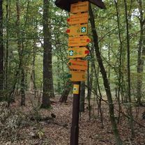
Route photos


Route quality
Waytypes & surfaces along the route
Waytypes
Track
9.6 km
(51 %)
Quiet road
2.8 km
(15 %)
Surfaces
Paved
11.4 km
(60 %)
Unpaved
1.7 km
(9 %)
Asphalt
11.4 km
(60 %)
Gravel
1.1 km
(6 %)
Continue with Bikemap
Use, edit, or download this cycling route
You would like to ride Nationalpark Thayatal Nord Teil 2 or customize it for your own trip? Here is what you can do with this Bikemap route:
Free features
- Save this route as favorite or in collections
- Copy & plan your own version of this route
- Sync your route with Garmin or Wahoo
Premium features
Free trial for 3 days, or one-time payment. More about Bikemap Premium.
- Navigate this route on iOS & Android
- Export a GPX / KML file of this route
- Create your custom printout (try it for free)
- Download this route for offline navigation
Discover more Premium features.
Get Bikemap PremiumFrom our community
Other popular routes starting in Blížkovice
 Vranov do znojma 10.09.25
- Distance
- 24 km
- Ascent
- 286 m
- Descent
- 559 m
- Location
- Blížkovice, South Moravian, Czechia
 Uvoľnená trasa
- Distance
- 37 km
- Ascent
- 600 m
- Descent
- 625 m
- Location
- Blížkovice, South Moravian, Czechia
 Berlin - Prag Etappe 19 Vranov nad Dyji - Slavonice
- Distance
- 44.4 km
- Ascent
- 596 m
- Descent
- 393 m
- Location
- Blížkovice, South Moravian, Czechia
 Lahofer Cup 2016-Miloš
- Distance
- 48 km
- Ascent
- 647 m
- Descent
- 644 m
- Location
- Blížkovice, South Moravian, Czechia
 Vranov nad Dyjí nach Korneuburg Hauptplatz
- Distance
- 112.1 km
- Ascent
- 1,049 m
- Descent
- 1,196 m
- Location
- Blížkovice, South Moravian, Czechia
 Vranov-Bítov a zpět přes Švýcarské údolí
- Distance
- 36.3 km
- Ascent
- 460 m
- Descent
- 461 m
- Location
- Blížkovice, South Moravian, Czechia
 Nationalpark Thayatal Nord Teil 2
- Distance
- 18.9 km
- Ascent
- 332 m
- Descent
- 397 m
- Location
- Blížkovice, South Moravian, Czechia
 2025_Morva_2.nap
- Distance
- 37 km
- Ascent
- 722 m
- Descent
- 723 m
- Location
- Blížkovice, South Moravian, Czechia
Open it in the app