

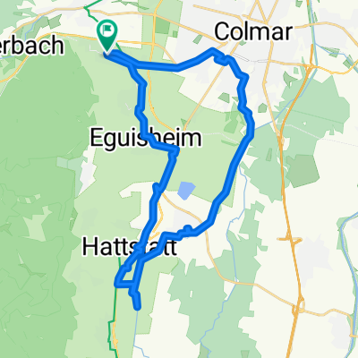
Allée Robert Sibler, Wintzenheim à 52D Chemin de la Speck, Colmar
A cycling route starting in Wintzenheim, Grand Est, France.
Overview
About this route
- 30 min
- Duration
- 13.5 km
- Distance
- 144 m
- Ascent
- 576 m
- Descent
- 27.1 km/h
- Avg. speed
- 620 m
- Max. altitude

Route quality
Waytypes & surfaces along the route
Waytypes
Quiet road
6.8 km
(50 %)
Road
2.8 km
(21 %)
Surfaces
Paved
10.3 km
(76 %)
Unpaved
0.3 km
(2 %)
Asphalt
10.3 km
(76 %)
Ground
0.3 km
(2 %)
Undefined
3 km
(22 %)
Continue with Bikemap
Use, edit, or download this cycling route
You would like to ride Allée Robert Sibler, Wintzenheim à 52D Chemin de la Speck, Colmar or customize it for your own trip? Here is what you can do with this Bikemap route:
Free features
- Save this route as favorite or in collections
- Copy & plan your own version of this route
- Sync your route with Garmin or Wahoo
Premium features
Free trial for 3 days, or one-time payment. More about Bikemap Premium.
- Navigate this route on iOS & Android
- Export a GPX / KML file of this route
- Create your custom printout (try it for free)
- Download this route for offline navigation
Discover more Premium features.
Get Bikemap PremiumFrom our community
Other popular routes starting in Wintzenheim
 Grand Ballon
- Distance
- 115.2 km
- Ascent
- 2,513 m
- Descent
- 2,070 m
- Location
- Wintzenheim, Grand Est, France
 Rapha Prestige Vosges
- Distance
- 142.9 km
- Ascent
- 2,982 m
- Descent
- 2,982 m
- Location
- Wintzenheim, Grand Est, France
 Basti_Vogesen3
- Distance
- 132.9 km
- Ascent
- 2,223 m
- Descent
- 2,223 m
- Location
- Wintzenheim, Grand Est, France
 Route du Vignoble
- Distance
- 154.5 km
- Ascent
- 193 m
- Descent
- 256 m
- Location
- Wintzenheim, Grand Est, France
 Petite boucle sud Wintzenheim 20km
- Distance
- 29.6 km
- Ascent
- 107 m
- Descent
- 107 m
- Location
- Wintzenheim, Grand Est, France
 Vogesen spezial
- Distance
- 135 km
- Ascent
- 2,246 m
- Descent
- 2,246 m
- Location
- Wintzenheim, Grand Est, France
 110km Grand Ballon
- Distance
- 110.1 km
- Ascent
- 1,512 m
- Descent
- 1,515 m
- Location
- Wintzenheim, Grand Est, France
 VTT HOHNACK LABAROCHE GALTZ
- Distance
- 48 km
- Ascent
- 1,470 m
- Descent
- 1,470 m
- Location
- Wintzenheim, Grand Est, France
Open it in the app