

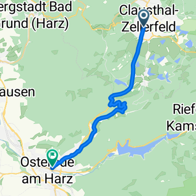
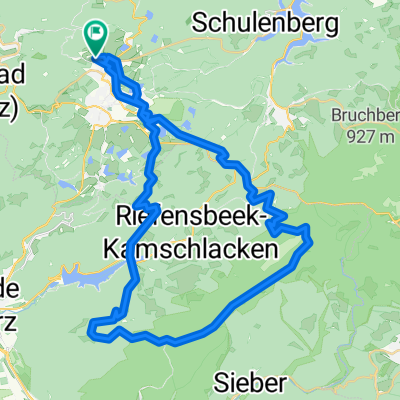
2023-09-04_Kreuzeck, Granestausee, Steinberg-Alm, Kreuzeck
A cycling route starting in Clausthal-Zellerfeld, Lower Saxony, Germany.
Overview
About this route
- 7 h 36 min
- Duration
- 27.3 km
- Distance
- 619 m
- Ascent
- 618 m
- Descent
- 3.6 km/h
- Avg. speed
- 695 m
- Max. altitude

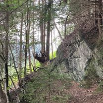
Route photos


Route quality
Waytypes & surfaces along the route
Waytypes
Track
21 km
(77 %)
Access road
3 km
(11 %)
Surfaces
Paved
9 km
(33 %)
Unpaved
15.3 km
(56 %)
Gravel
10.6 km
(39 %)
Asphalt
8.7 km
(32 %)
Continue with Bikemap
Use, edit, or download this cycling route
You would like to ride 2023-09-04_Kreuzeck, Granestausee, Steinberg-Alm, Kreuzeck or customize it for your own trip? Here is what you can do with this Bikemap route:
Free features
- Save this route as favorite or in collections
- Copy & plan your own version of this route
- Sync your route with Garmin or Wahoo
Premium features
Free trial for 3 days, or one-time payment. More about Bikemap Premium.
- Navigate this route on iOS & Android
- Export a GPX / KML file of this route
- Create your custom printout (try it for free)
- Download this route for offline navigation
Discover more Premium features.
Get Bikemap PremiumFrom our community
Other popular routes starting in Clausthal-Zellerfeld
 Hahnenklee, Goslar nach Hahnenklee, Goslar
- Distance
- 28.8 km
- Ascent
- 714 m
- Descent
- 707 m
- Location
- Clausthal-Zellerfeld, Lower Saxony, Germany
 Goslar 3
- Distance
- 13.8 km
- Ascent
- 162 m
- Descent
- 509 m
- Location
- Clausthal-Zellerfeld, Lower Saxony, Germany
 Altarklippen
- Distance
- 34.6 km
- Ascent
- 764 m
- Descent
- 809 m
- Location
- Clausthal-Zellerfeld, Lower Saxony, Germany
 Tour 1 aus der Tour 03/07
- Distance
- 73.6 km
- Ascent
- 1,193 m
- Descent
- 1,362 m
- Location
- Clausthal-Zellerfeld, Lower Saxony, Germany
 Buntenbock > Harzrunde West 82km
- Distance
- 82 km
- Ascent
- 928 m
- Descent
- 928 m
- Location
- Clausthal-Zellerfeld, Lower Saxony, Germany
 Sösestausee und Acker
- Distance
- 47.4 km
- Ascent
- 831 m
- Descent
- 830 m
- Location
- Clausthal-Zellerfeld, Lower Saxony, Germany
 Mit dem MTB im Westharz
- Distance
- 50.7 km
- Ascent
- 730 m
- Descent
- 730 m
- Location
- Clausthal-Zellerfeld, Lower Saxony, Germany
 Clausthal-Zellerfeld: CC-Runde
- Distance
- 38.2 km
- Ascent
- 701 m
- Descent
- 701 m
- Location
- Clausthal-Zellerfeld, Lower Saxony, Germany
Open it in the app