

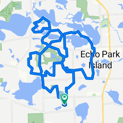
Wheels To The Road (WTTR) - Fire Station #5
A cycling route starting in Franklin, Michigan, United States.
Overview
About this route
Route designed by West Bloomfield Parks Wheels To The Road bike club for the "Ride Free in 2023" challenge. This is the "Fire Station #5" loop that starts and ends at the Fire Station #5.
- -:--
- Duration
- 8.5 km
- Distance
- 30 m
- Ascent
- 30 m
- Descent
- ---
- Avg. speed
- 278 m
- Max. altitude
Route quality
Waytypes & surfaces along the route
Waytypes
Quiet road
7.5 km
(88 %)
Access road
0.6 km
(7 %)
Surfaces
Paved
0.1 km
(1 %)
Concrete
0.1 km
(1 %)
Undefined
8.5 km
(99 %)
Continue with Bikemap
Use, edit, or download this cycling route
You would like to ride Wheels To The Road (WTTR) - Fire Station #5 or customize it for your own trip? Here is what you can do with this Bikemap route:
Free features
- Save this route as favorite or in collections
- Copy & plan your own version of this route
- Sync your route with Garmin or Wahoo
Premium features
Free trial for 3 days, or one-time payment. More about Bikemap Premium.
- Navigate this route on iOS & Android
- Export a GPX / KML file of this route
- Create your custom printout (try it for free)
- Download this route for offline navigation
Discover more Premium features.
Get Bikemap PremiumFrom our community
Other popular routes starting in Franklin
 Hilly Loop
- Distance
- 28.8 km
- Ascent
- 176 m
- Descent
- 178 m
- Location
- Franklin, Michigan, United States
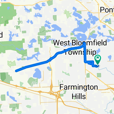 Slow ride in West Bloomfield
- Distance
- 47.4 km
- Ascent
- 200 m
- Descent
- 193 m
- Location
- Franklin, Michigan, United States
 Easy ride in Bloomfield Hills
- Distance
- 3.8 km
- Ascent
- 25 m
- Descent
- 27 m
- Location
- Franklin, Michigan, United States
 7040 Ten Hill Rd, West Bloomfield to 870 Parkdale Rd, Rochester
- Distance
- 31.1 km
- Ascent
- 160 m
- Descent
- 185 m
- Location
- Franklin, Michigan, United States
 LunchRide
- Distance
- 32.5 km
- Ascent
- 137 m
- Descent
- 138 m
- Location
- Franklin, Michigan, United States
 FromLeslieToVRBO
- Distance
- 20.6 km
- Ascent
- 33 m
- Descent
- 100 m
- Location
- Franklin, Michigan, United States
 Smooth Franklin
- Distance
- 15.2 km
- Ascent
- 87 m
- Descent
- 85 m
- Location
- Franklin, Michigan, United States
 Relaxed route in Bloomfield Hills
- Distance
- 4.2 km
- Ascent
- 37 m
- Descent
- 49 m
- Location
- Franklin, Michigan, United States
Open it in the app