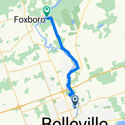
401 Crossing #1 - Cannifton Rd
- 4.1 km
- 13 m
- 17 m
- Belleville, Ontario, Canada
A cycling route starting in Belleville, Ontario, Canada.
Overview
From this end point you have these options to access most destinations:
(Westbound)
-Cross to the north side and continue riding on Bell Blvd.
Walk your bike along Bell Blvd and access stores by connecting parking lots.
Travel south on N Park St. Cut through North Front Centre's parking lot. Continue on Tracey St. Access stores via pedestrian network (Canadian Tire Trail or Lemoine St Path).
(Southbound)
Skip Bell Blvd Bridge and continue south on Cannifton Rd.
Connect to Riverfront Trail from Bell Blvd and follow downtown.
Connect to Moira St E from Bell Blvd and connect to Riverfront Trail at College St.
or Stay on Moira St E and turn left on Pinnacle St or Front St.
NOTE: The Riverfront Trail is unpaved north of College St.
created this 14 years ago
Route quality
Road
1.7 km
(41 %)
Quiet road
0.7 km
(18 %)
Paved
3.4 km
(83 %)
Asphalt
3.4 km
(83 %)
Undefined
0.7 km
(17 %)
Continue with Bikemap
You would like to ride 401 Crossing #1 - Cannifton Rd or customize it for your own trip? Here is what you can do with this Bikemap route:
Free trial for 3 days, or one-time payment. More about Bikemap Premium.
Discover more Premium features.
Get Bikemap PremiumFrom our community
Open it in the app