

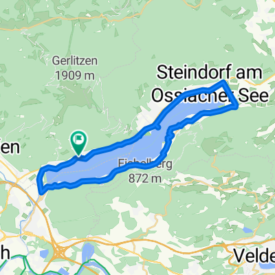
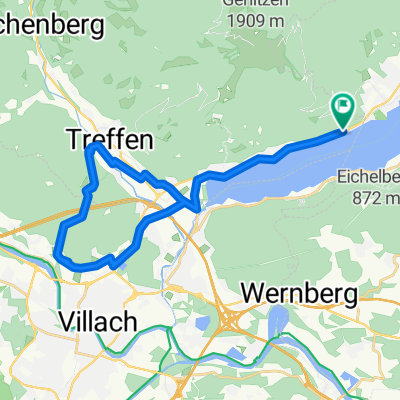
Ironmanrunde
A cycling route starting in Ossiach, Carinthia, Austria.
Overview
About this route
The (flat) route over the notorious Rupertiberg and back through the Rosental – which is a segment of the Klagenfurt Ironman – is certainly underestimated; it includes many long, visible straight sections, but also a variety of small hills and a few sharp climbs. In the end, it is a combination of length and elevation gain that the day’s winner mastered.
- -:--
- Duration
- 84.2 km
- Distance
- 869 m
- Ascent
- 718 m
- Descent
- ---
- Avg. speed
- ---
- Max. altitude

Route quality
Waytypes & surfaces along the route
Waytypes
Quiet road
16 km
(19 %)
Track
2.5 km
(3 %)
Surfaces
Paved
63.2 km
(75 %)
Unpaved
3.4 km
(4 %)
Asphalt
62.3 km
(74 %)
Gravel
2.5 km
(3 %)
Continue with Bikemap
Use, edit, or download this cycling route
You would like to ride Ironmanrunde or customize it for your own trip? Here is what you can do with this Bikemap route:
Free features
- Save this route as favorite or in collections
- Copy & plan your own version of this route
- Split it into stages to create a multi-day tour
- Sync your route with Garmin or Wahoo
Premium features
Free trial for 3 days, or one-time payment. More about Bikemap Premium.
- Navigate this route on iOS & Android
- Export a GPX / KML file of this route
- Create your custom printout (try it for free)
- Download this route for offline navigation
Discover more Premium features.
Get Bikemap PremiumFrom our community
Other popular routes starting in Ossiach
 Köstenberger Dorfweg nach Altossiach Dammweg
- Distance
- 9.2 km
- Ascent
- 155 m
- Descent
- 409 m
- Location
- Ossiach, Carinthia, Austria
 Sonnenhügel_ Ossiachersee_Rundfahrt
- Distance
- 29.7 km
- Ascent
- 303 m
- Descent
- 328 m
- Location
- Ossiach, Carinthia, Austria
 Lindenweg nach Tiebel
- Distance
- 28.1 km
- Ascent
- 644 m
- Descent
- 331 m
- Location
- Ossiach, Carinthia, Austria
 Steindorf am Ossiacher See - Pontebba (2/2)
- Distance
- 58.5 km
- Ascent
- 969 m
- Descent
- 763 m
- Location
- Ossiach, Carinthia, Austria
 Dach der Tour
- Distance
- 78 km
- Ascent
- 1,736 m
- Descent
- 1,179 m
- Location
- Ossiach, Carinthia, Austria
 Dorfstraße, Treffen am Ossiacher See to Dorfstraße, Treffen am Ossiacher See
- Distance
- 29.7 km
- Ascent
- 393 m
- Descent
- 402 m
- Location
- Ossiach, Carinthia, Austria
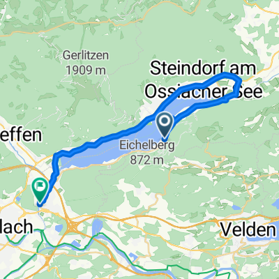
 Route in Treffen am Ossiacher See
- Distance
- 33.5 km
- Ascent
- 653 m
- Descent
- 650 m
- Location
- Ossiach, Carinthia, Austria
 Runde um Ossiacher See
- Distance
- 25.4 km
- Ascent
- 136 m
- Descent
- 147 m
- Location
- Ossiach, Carinthia, Austria
Open it in the app