

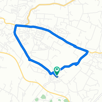
X. Phiêng Luông, H. Mộc Châu to TT. Nông Trường Mộc Châu, H. Mộc Châu
A cycling route starting in Mộc Châu, Sơn La Province, Vietnam.
Overview
About this route
- 1 h 19 min
- Duration
- 16.4 km
- Distance
- 343 m
- Ascent
- 273 m
- Descent
- 12.5 km/h
- Avg. speed
- 1,067 m
- Max. altitude

Route quality
Waytypes & surfaces along the route
Waytypes
Quiet road
12.6 km
(77 %)
Road
2.5 km
(15 %)
Continue with Bikemap
Use, edit, or download this cycling route
You would like to ride X. Phiêng Luông, H. Mộc Châu to TT. Nông Trường Mộc Châu, H. Mộc Châu or customize it for your own trip? Here is what you can do with this Bikemap route:
Free features
- Save this route as favorite or in collections
- Copy & plan your own version of this route
- Sync your route with Garmin or Wahoo
Premium features
Free trial for 3 days, or one-time payment. More about Bikemap Premium.
- Navigate this route on iOS & Android
- Export a GPX / KML file of this route
- Create your custom printout (try it for free)
- Download this route for offline navigation
Discover more Premium features.
Get Bikemap PremiumFrom our community
Other popular routes starting in Mộc Châu
 Easy ride
- Distance
- 7.5 km
- Ascent
- 90 m
- Descent
- 64 m
- Location
- Mộc Châu, Sơn La Province, Vietnam
 X. Phiêng Luông, H. Mộc Châu to TT. Nông Trường Mộc Châu, H. Mộc Châu
- Distance
- 16.4 km
- Ascent
- 343 m
- Descent
- 273 m
- Location
- Mộc Châu, Sơn La Province, Vietnam
 MOC CHAU-HANOI
- Distance
- 196.2 km
- Ascent
- 1,094 m
- Descent
- 2,033 m
- Location
- Mộc Châu, Sơn La Province, Vietnam
 Day 2: Moc Chau - Yen Chau
- Distance
- 52.6 km
- Ascent
- 258 m
- Descent
- 841 m
- Location
- Mộc Châu, Sơn La Province, Vietnam
 4 Moc Chau-Yen Chau
- Distance
- 42.5 km
- Ascent
- 747 m
- Descent
- 1,385 m
- Location
- Mộc Châu, Sơn La Province, Vietnam
 Moc Chau-Mai Chau
- Distance
- 61.5 km
- Ascent
- 662 m
- Descent
- 1,338 m
- Location
- Mộc Châu, Sơn La Province, Vietnam
 Moc Chau - Yen Chau
- Distance
- 51.7 km
- Ascent
- 152 m
- Descent
- 706 m
- Location
- Mộc Châu, Sơn La Province, Vietnam
 Steady ride
- Distance
- 11.3 km
- Ascent
- 99 m
- Descent
- 71 m
- Location
- Mộc Châu, Sơn La Province, Vietnam
Open it in the app