

okruh blansko JV
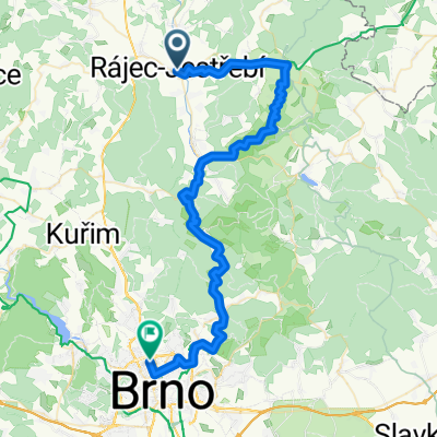
A cycling route starting in Rájec-Jestřebí, South Moravian, Czechia.
Overview
About this route
Overall a relaxed route with gentle hills, on the way to Hut Frantiska, Býčí skála, and in Křtin then the Baroque church by Santini.
- -:--
- Duration
- 41.9 km
- Distance
- 893 m
- Ascent
- 861 m
- Descent
- ---
- Avg. speed
- 499 m
- Max. altitude
Route quality
Waytypes & surfaces along the route
Waytypes
Road
11.3 km
(27 %)
Access road
2.9 km
(7 %)
Surfaces
Paved
39.4 km
(94 %)
Asphalt
39.4 km
(94 %)
Undefined
2.5 km
(6 %)
Route highlights
Points of interest along the route

Point of interest after 19 km
Huť Františka

Point of interest after 26.1 km
Barokní kostel od Santiniho, poutní místo
Continue with Bikemap
Use, edit, or download this cycling route
You would like to ride okruh blansko JV or customize it for your own trip? Here is what you can do with this Bikemap route:
Free features
- Save this route as favorite or in collections
- Copy & plan your own version of this route
- Sync your route with Garmin or Wahoo
Premium features
Free trial for 3 days, or one-time payment. More about Bikemap Premium.
- Navigate this route on iOS & Android
- Export a GPX / KML file of this route
- Create your custom printout (try it for free)
- Download this route for offline navigation
Discover more Premium features.
Get Bikemap PremiumFrom our community
Other popular routes starting in Rájec-Jestřebí
 Krásná Krasová
- Distance
- 69.1 km
- Ascent
- 676 m
- Descent
- 738 m
- Location
- Rájec-Jestřebí, South Moravian, Czechia
 Rájec-Jestřebí - Sloup 🚴 - Macocha - Blansko - Adamov - Brno
- Distance
- 52.8 km
- Ascent
- 410 m
- Descent
- 489 m
- Location
- Rájec-Jestřebí, South Moravian, Czechia
 Rajec - Moravsky Kras - Rajec
- Distance
- 36.5 km
- Ascent
- 507 m
- Descent
- 509 m
- Location
- Rájec-Jestřebí, South Moravian, Czechia
 Blanenská, Rájec-Jestřebí do Blanenská, Rájec-Jestřebí
- Distance
- 71.4 km
- Ascent
- 1,334 m
- Descent
- 1,335 m
- Location
- Rájec-Jestřebí, South Moravian, Czechia
 okruh blansko JV
- Distance
- 41.9 km
- Ascent
- 893 m
- Descent
- 861 m
- Location
- Rájec-Jestřebí, South Moravian, Czechia
 Jeskyně Mor. Kr.
- Distance
- 54.1 km
- Ascent
- 479 m
- Descent
- 538 m
- Location
- Rájec-Jestřebí, South Moravian, Czechia
 Rajec-Jestřebí, Sloup, Adamov, Brno
- Distance
- 51.8 km
- Ascent
- 448 m
- Descent
- 511 m
- Location
- Rájec-Jestřebí, South Moravian, Czechia
 Rájec-Jestřebí_Bystrc
- Distance
- 45.3 km
- Ascent
- 508 m
- Descent
- 484 m
- Location
- Rájec-Jestřebí, South Moravian, Czechia
Open it in the app