

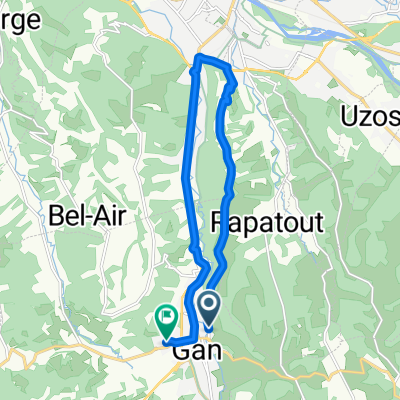
**13-V. Gan - Lac de Migouelou (198,5 Km)
A cycling route starting in Gan, Nouvelle-Aquitaine, France.
Overview
About this route
- -:--
- Duration
- 198.3 km
- Distance
- 6,294 m
- Ascent
- 4,996 m
- Descent
- ---
- Avg. speed
- 1,712 m
- Max. altitude
Route quality
Waytypes & surfaces along the route
Waytypes
Road
83.3 km
(42 %)
Quiet road
5.9 km
(3 %)
Undefined
109.1 km
(55 %)
Surfaces
Paved
126.9 km
(64 %)
Asphalt
126.9 km
(64 %)
Undefined
71.4 km
(36 %)
Route highlights
Points of interest along the route
\"")
Point of interest after 79.7 km
Col de la HOURCÈRE (HC) Km 81,2 · 1.440 m
\"")
Point of interest after 89.1 km
Col de SOUDET (?) Km 90,1 · 1.520 m.
\"")
Point of interest after 102.8 km
Col de BOUÉSOU (3) Km 103,7 · 1.009 m.
\"")
Point of interest after 132.2 km
Col de MARIE BLANQUE (1) Km 133 · 1.035 m.
\"")
Point of interest after 152.3 km
Sprint LARUNS Km 153,5
\"")
Point of interest after 170.3 km
Col d'AUBISQUE (HC) Km 170,8 · 1.709 m.
\"")
Point of interest after 198.2 km
LAC DE MIGOUELOU (HC) Km 198,5 · 1.505 m.
Continue with Bikemap
Use, edit, or download this cycling route
You would like to ride **13-V. Gan - Lac de Migouelou (198,5 Km) or customize it for your own trip? Here is what you can do with this Bikemap route:
Free features
- Save this route as favorite or in collections
- Copy & plan your own version of this route
- Split it into stages to create a multi-day tour
- Sync your route with Garmin or Wahoo
Premium features
Free trial for 3 days, or one-time payment. More about Bikemap Premium.
- Navigate this route on iOS & Android
- Export a GPX / KML file of this route
- Create your custom printout (try it for free)
- Download this route for offline navigation
Discover more Premium features.
Get Bikemap PremiumFrom our community
Other popular routes starting in Gan
 19-V. Gan - Fleurance (162 Km)
- Distance
- 162.1 km
- Ascent
- 1,390 m
- Descent
- 1,490 m
- Location
- Gan, Nouvelle-Aquitaine, France
 **13-V. Gan - Lac de Migouelou (198,5 Km)
- Distance
- 198.3 km
- Ascent
- 6,294 m
- Descent
- 4,996 m
- Location
- Gan, Nouvelle-Aquitaine, France
 De Route de Nay à Rue des Passereaux
- Distance
- 13.9 km
- Ascent
- 203 m
- Descent
- 231 m
- Location
- Gan, Nouvelle-Aquitaine, France
 col de soudet cut
- Distance
- 143.2 km
- Ascent
- 2,941 m
- Descent
- 2,941 m
- Location
- Gan, Nouvelle-Aquitaine, France
 Gelos rodellar
- Distance
- 238 km
- Ascent
- 6,878 m
- Descent
- 6,445 m
- Location
- Gan, Nouvelle-Aquitaine, France
 cap 2
cap 2- Distance
- 15.4 km
- Ascent
- 361 m
- Descent
- 358 m
- Location
- Gan, Nouvelle-Aquitaine, France
 Gelos Toulouse
- Distance
- 215.7 km
- Ascent
- 1,193 m
- Descent
- 1,176 m
- Location
- Gan, Nouvelle-Aquitaine, France
 Chemin des Coteaux de Guindalos 325, Gelos to Chemin des Coteaux de Guindalos 325, Gelos
- Distance
- 61.3 km
- Ascent
- 846 m
- Descent
- 842 m
- Location
- Gan, Nouvelle-Aquitaine, France
Open it in the app