

RUTA DE DON QUIJOTE (Virgen de la Cabeza)
A cycling route starting in Viso del Marqués, Castille-La Mancha, Spain.
Overview
About this route
Transitando por Sierra Madrona en la Ruta que hizo el hidalgo caballero don Alonso Quijano por la Sierra Morena,
- -:--
- Duration
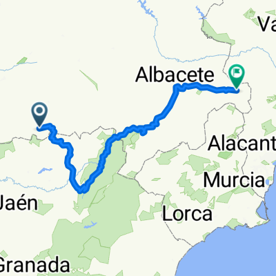
- 101.2 km
- Distance
- 1,148 m
- Ascent
- 1,305 m
- Descent
- ---
- Avg. speed
- ---
- Max. altitude

Route quality
Waytypes & surfaces along the route
Waytypes
Road
99.7 km
(99 %)
Path
0.9 km
(<1 %)
Surfaces
Paved
20.1 km
(20 %)
Asphalt
20.1 km
(20 %)
Undefined
81 km
(80 %)
Continue with Bikemap
Use, edit, or download this cycling route
You would like to ride RUTA DE DON QUIJOTE (Virgen de la Cabeza) or customize it for your own trip? Here is what you can do with this Bikemap route:
Free features
- Save this route as favorite or in collections
- Copy & plan your own version of this route
- Split it into stages to create a multi-day tour
- Sync your route with Garmin or Wahoo
Premium features
Free trial for 3 days, or one-time payment. More about Bikemap Premium.
- Navigate this route on iOS & Android
- Export a GPX / KML file of this route
- Create your custom printout (try it for free)
- Download this route for offline navigation
Discover more Premium features.
Get Bikemap PremiumFrom our community
Other popular routes starting in Viso del Marqués
 Viso del Marqués - Santa Elena por el Collado de la Estrella
- Distance
- 58.4 km
- Ascent
- 1,554 m
- Descent
- 1,534 m
- Location
- Viso del Marqués, Castille-La Mancha, Spain
 Viso del Marques-Miranda del Rey-La Alisada
- Distance
- 27.8 km
- Ascent
- 654 m
- Descent
- 778 m
- Location
- Viso del Marqués, Castille-La Mancha, Spain
 Viso-Huertezuelas-Solanilla-Viso
- Distance
- 127.3 km
- Ascent
- 1,370 m
- Descent
- 1,360 m
- Location
- Viso del Marqués, Castille-La Mancha, Spain
 RUTA DE DON QUIJOTE (Virgen de la Cabeza)
- Distance
- 101.2 km
- Ascent
- 1,148 m
- Descent
- 1,305 m
- Location
- Viso del Marqués, Castille-La Mancha, Spain
 Itinéraire modéré en Almansa
- Distance
- 448.4 km
- Ascent
- 6,416 m
- Descent
- 6,525 m
- Location
- Viso del Marqués, Castille-La Mancha, Spain
 CARLOS III
- Distance
- 52.1 km
- Ascent
- 617 m
- Descent
- 975 m
- Location
- Viso del Marqués, Castille-La Mancha, Spain
 Ruta 14 Abril
- Distance
- 50.8 km
- Ascent
- 1,139 m
- Descent
- 1,139 m
- Location
- Viso del Marqués, Castille-La Mancha, Spain
 Viso - Collado de la Estrella - Miranda del Rey
- Distance
- 25.4 km
- Ascent
- 632 m
- Descent
- 696 m
- Location
- Viso del Marqués, Castille-La Mancha, Spain
Open it in the app