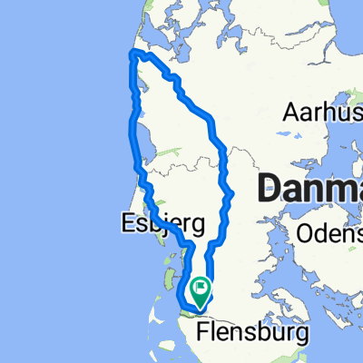
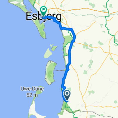
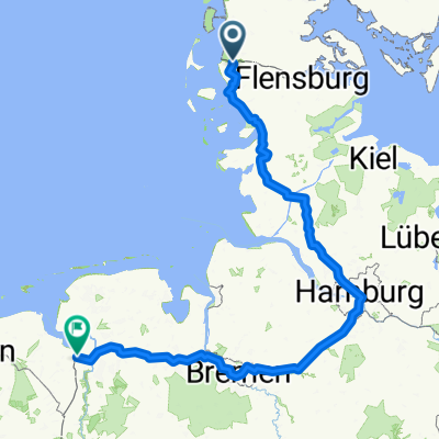
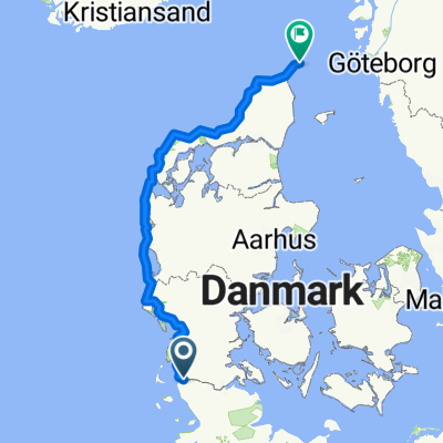
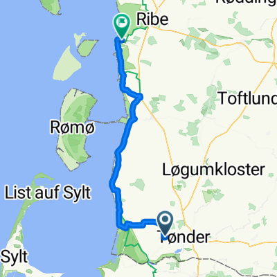
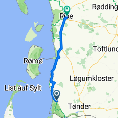
Koldin Niebul
A cycling route starting in Tønder, Region South Denmark, Denmark.
Overview
About this route
- -:--
- Duration
- 85.6 km
- Distance
- 19 m
- Ascent
- 18 m
- Descent
- ---
- Avg. speed
- ---
- Avg. speed
Route quality
Waytypes & surfaces along the route
Waytypes
Undefined
85.6 km
(100 %)
Surfaces
Undefined
85.6 km
(100 %)
Route highlights
Points of interest along the route
Point of interest after 74.4 km
Continue with Bikemap
Use, edit, or download this cycling route
You would like to ride Koldin Niebul or customize it for your own trip? Here is what you can do with this Bikemap route:
Free features
- Save this route as favorite or in collections
- Copy & plan your own version of this route
- Sync your route with Garmin or Wahoo
Premium features
Free trial for 3 days, or one-time payment. More about Bikemap Premium.
- Navigate this route on iOS & Android
- Export a GPX / KML file of this route
- Create your custom printout (try it for free)
- Download this route for offline navigation
Discover more Premium features.
Get Bikemap PremiumFrom our community
Other popular routes starting in Tønder
- Vestkystruten
- Distance
- 563.5 km
- Ascent
- 1,002 m
- Descent
- 1,003 m
- Location
- Tønder, Region South Denmark, Denmark
- From Højer to Åbenrå
- Distance
- 113.7 km
- Ascent
- 397 m
- Descent
- 370 m
- Location
- Tønder, Region South Denmark, Denmark
- Tønder to Åbenrå
- Distance
- 180.5 km
- Ascent
- 855 m
- Descent
- 848 m
- Location
- Tønder, Region South Denmark, Denmark
- Lægan to Vadehavscentret
- Distance
- 56.9 km
- Ascent
- 61 m
- Descent
- 65 m
- Location
- Tønder, Region South Denmark, Denmark
- Danemark
- Distance
- 518.7 km
- Ascent
- 760 m
- Descent
- 761 m
- Location
- Tønder, Region South Denmark, Denmark
- 2023 v1
- Distance
- 586.9 km
- Ascent
- 1,247 m
- Descent
- 1,250 m
- Location
- Tønder, Region South Denmark, Denmark
- Traversée danemark
- Distance
- 414.9 km
- Ascent
- 300 m
- Descent
- 299 m
- Location
- Tønder, Region South Denmark, Denmark
- tandemXeurope 2009 - Day 21
- Distance
- 116.6 km
- Ascent
- 202 m
- Descent
- 143 m
- Location
- Tønder, Region South Denmark, Denmark