

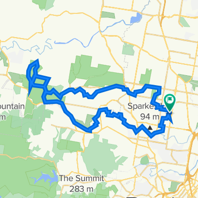
Stafford to Allpass Pde
A cycling route starting in Stafford Heights, Queensland, Australia.
Overview
About this route
- -:--
- Duration
- 40.5 km
- Distance
- 186 m
- Ascent
- 190 m
- Descent
- ---
- Avg. speed
- 70 m
- Max. altitude
Route quality
Waytypes & surfaces along the route
Waytypes
Cycleway
23.1 km
(57 %)
Road
8.1 km
(20 %)
Surfaces
Paved
39.3 km
(97 %)
Concrete
21.9 km
(54 %)
Asphalt
11.3 km
(28 %)
Route highlights
Points of interest along the route
Point of interest after 0 km
Continue with Bikemap
Use, edit, or download this cycling route
You would like to ride Stafford to Allpass Pde or customize it for your own trip? Here is what you can do with this Bikemap route:
Free features
- Save this route as favorite or in collections
- Copy & plan your own version of this route
- Sync your route with Garmin or Wahoo
Premium features
Free trial for 3 days, or one-time payment. More about Bikemap Premium.
- Navigate this route on iOS & Android
- Export a GPX / KML file of this route
- Create your custom printout (try it for free)
- Download this route for offline navigation
Discover more Premium features.
Get Bikemap PremiumFrom our community
Other popular routes starting in Stafford Heights
 Apr 23 Stafford to Jinker Track
- Distance
- 23 km
- Ascent
- 293 m
- Descent
- 294 m
- Location
- Stafford Heights, Queensland, Australia
 Stafford to Allpass Pde
- Distance
- 40.5 km
- Ascent
- 186 m
- Descent
- 190 m
- Location
- Stafford Heights, Queensland, Australia
 Culworth Street 1, Chermside West to Ainsdale Street 30, Chermside West
- Distance
- 75.9 km
- Ascent
- 741 m
- Descent
- 741 m
- Location
- Stafford Heights, Queensland, Australia
 The Chermside Chase
- Distance
- 11.5 km
- Ascent
- 72 m
- Descent
- 110 m
- Location
- Stafford Heights, Queensland, Australia
 Pangeza, Albany Creek, Carseldine, Pangeza
- Distance
- 43.2 km
- Ascent
- 423 m
- Descent
- 419 m
- Location
- Stafford Heights, Queensland, Australia
 Stafford to Samford Conservation Park trial run 12 Sept 21
- Distance
- 44.8 km
- Ascent
- 434 m
- Descent
- 434 m
- Location
- Stafford Heights, Queensland, Australia
 Chermside west Arana Hills
- Distance
- 38.1 km
- Ascent
- 144 m
- Descent
- 153 m
- Location
- Stafford Heights, Queensland, Australia
 Stafford, Bridgeman Downs, Ferny Grove
- Distance
- 32.9 km
- Ascent
- 884 m
- Descent
- 868 m
- Location
- Stafford Heights, Queensland, Australia
Open it in the app