

2008/08 2. Tag Tour de Jumelage Baunatal-Vire
A cycling route starting in Weilburg, Hesse, Germany.
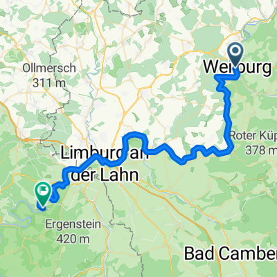
Overview
About this route
From Weilburg Odersbach we ride via Beslich, Hadamar to Montabaur. From here, unfortunately, we have to ride on the 49 until we reach the L127 to get to Koblenz. Then we take the ferry across the Rhine. The Mosel Wine Route will accompany us until Treis Karden. From here, there are two route options: 1. either as drawn in the route plan on the K35 over the steep slopes of the vineyards to Bruttig-Fankel approximately 8.1 km with 470 meters of elevation; 2. along the Mosel through Cochem to Bruttig-Fankel, approximately 18 km with 160 meters of elevation. From Bruttig-Fankel then over Bremm, Alf and Reil to Traben.
- -:--
- Duration
- 156.8 km
- Distance
- 2,038 m
- Ascent
- 2,133 m
- Descent
- ---
- Avg. speed
- 454 m
- Max. altitude
Route quality
Waytypes & surfaces along the route
Waytypes
Road
25.1 km
(16 %)
Track
11 km
(7 %)
Surfaces
Paved
125.4 km
(80 %)
Unpaved
9.4 km
(6 %)
Asphalt
125.4 km
(80 %)
Unpaved (undefined)
6.3 km
(4 %)
Route highlights
Points of interest along the route
Point of interest after 156.8 km
Hotel
Continue with Bikemap
Use, edit, or download this cycling route
You would like to ride 2008/08 2. Tag Tour de Jumelage Baunatal-Vire or customize it for your own trip? Here is what you can do with this Bikemap route:
Free features
- Save this route as favorite or in collections
- Copy & plan your own version of this route
- Split it into stages to create a multi-day tour
- Sync your route with Garmin or Wahoo
Premium features
Free trial for 3 days, or one-time payment. More about Bikemap Premium.
- Navigate this route on iOS & Android
- Export a GPX / KML file of this route
- Create your custom printout (try it for free)
- Download this route for offline navigation
Discover more Premium features.
Get Bikemap PremiumFrom our community
Other popular routes starting in Weilburg
 Kloster Kreuzberg Tour 2015
- Distance
- 170.6 km
- Ascent
- 1,760 m
- Descent
- 1,043 m
- Location
- Weilburg, Hesse, Germany
 Weilburg - Laubuseschbach
- Distance
- 15.6 km
- Ascent
- 249 m
- Descent
- 100 m
- Location
- Weilburg, Hesse, Germany
 Weilburg BHF - Gießen HBF
- Distance
- 48.5 km
- Ascent
- 99 m
- Descent
- 83 m
- Location
- Weilburg, Hesse, Germany
 B456 nach Hauptstraße
- Distance
- 48.8 km
- Ascent
- 593 m
- Descent
- 632 m
- Location
- Weilburg, Hesse, Germany
 Busroute Pendelbus Weilburgman 2015
- Distance
- 16.3 km
- Ascent
- 228 m
- Descent
- 221 m
- Location
- Weilburg, Hesse, Germany
 Weilburg 3. Etappe
- Distance
- 22.6 km
- Ascent
- 469 m
- Descent
- 374 m
- Location
- Weilburg, Hesse, Germany
 Weilburg - Kubach - Weilburg HK Radwanderserie 8.06.2016
- Distance
- 20.6 km
- Ascent
- 280 m
- Descent
- 277 m
- Location
- Weilburg, Hesse, Germany
 Über Berg und Lahntal
- Distance
- 21.7 km
- Ascent
- 326 m
- Descent
- 320 m
- Location
- Weilburg, Hesse, Germany
Open it in the app