

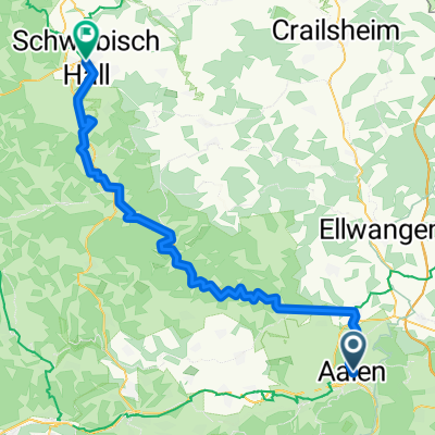
Kocher-Jagst-Radweg
A cycling route starting in Aalen, Baden-Wurttemberg, Germany.
Overview
About this route
- -:--
- Duration
- 341.7 km
- Distance
- 3,250 m
- Ascent
- 3,250 m
- Descent
- ---
- Avg. speed
- 671 m
- Max. altitude

Route quality
Waytypes & surfaces along the route
Waytypes
Track
136.7 km
(40 %)
Quiet road
71.8 km
(21 %)
Surfaces
Paved
304.1 km
(89 %)
Unpaved
6.8 km
(2 %)
Asphalt
266.5 km
(78 %)
Paved (undefined)
34.2 km
(10 %)
Route highlights
Points of interest along the route
Accommodation after 55.7 km
Rosenstüble 0791 204 60 116
Accommodation after 111 km
Kelterhotel Fröscher
Accommodation after 153.1 km
Weingut Politschek 0175 8668062
Accommodation after 223.7 km
Biohof verborgener Winkel 07937 803637
Accommodation after 277.8 km
Zur Krone 90,- +49 7951 22965
Accommodation after 338.3 km
Hotel Scholz 07361/567-0
Continue with Bikemap
Use, edit, or download this cycling route
You would like to ride Kocher-Jagst-Radweg or customize it for your own trip? Here is what you can do with this Bikemap route:
Free features
- Save this route as favorite or in collections
- Copy & plan your own version of this route
- Split it into stages to create a multi-day tour
- Sync your route with Garmin or Wahoo
Premium features
Free trial for 3 days, or one-time payment. More about Bikemap Premium.
- Navigate this route on iOS & Android
- Export a GPX / KML file of this route
- Create your custom printout (try it for free)
- Download this route for offline navigation
Discover more Premium features.
Get Bikemap PremiumFrom our community
Other popular routes starting in Aalen
 Kochertal Aalen - Schwäbisch Hall - Bad Friedrichsau Tag 1
- Distance
- 73.3 km
- Ascent
- 205 m
- Descent
- 369 m
- Location
- Aalen, Baden-Wurttemberg, Germany
 Welland
- Distance
- 32.8 km
- Ascent
- 203 m
- Descent
- 193 m
- Location
- Aalen, Baden-Wurttemberg, Germany
 Kocher-Jagst-Radweg
- Distance
- 341.7 km
- Ascent
- 3,250 m
- Descent
- 3,250 m
- Location
- Aalen, Baden-Wurttemberg, Germany
 Braunen Berg - Ipf - Baldern - Kapfenburg
- Distance
- 53.6 km
- Ascent
- 834 m
- Descent
- 834 m
- Location
- Aalen, Baden-Wurttemberg, Germany
 Remstalradroute
- Distance
- 72.6 km
- Ascent
- 3,847 m
- Descent
- 4,276 m
- Location
- Aalen, Baden-Wurttemberg, Germany
 Aalen - Schwäbisch Hall 67km
- Distance
- 67.3 km
- Ascent
- 981 m
- Descent
- 1,104 m
- Location
- Aalen, Baden-Wurttemberg, Germany
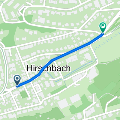 Home_Hirschbach
- Distance
- 0.8 km
- Ascent
- 25 m
- Descent
- 0 m
- Location
- Aalen, Baden-Wurttemberg, Germany
 Kocher-Jagst-Radweg
- Distance
- 338.1 km
- Ascent
- 4,732 m
- Descent
- 4,733 m
- Location
- Aalen, Baden-Wurttemberg, Germany
Open it in the app