

Laviana-San Mamés-Laviana
A cycling route starting in Pola de Laviana, Principality of Asturias, Spain.
Overview
About this route
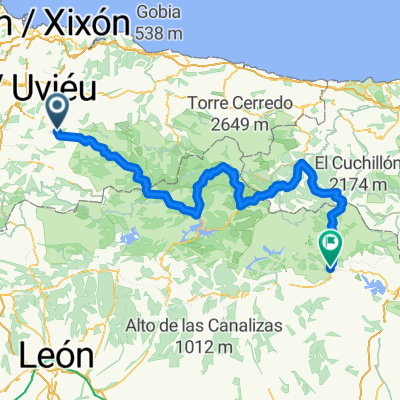
Route of a few kilometers, a bit more than those indicated, I think about 18 or so. Medium good asphalt, departure from Laviana AS-17 until reaching the Blimea junction in Sierra where we head via SM-1 to tackle the ascent of La Molatera (left junction) with an average gradient of 10 %, maintaining almost the entire climb, then before this point at 6-7 % which is quite tough, to culminate at San Mamés with a false flat rising at 2 %. We will then begin the descent towards La Molatera but by another alternative route with poor asphalt condition due to gravel, but which can be comfortably ridden with a descent that your legs will appreciate, reaching again the La Molatera junction on its right side and leading us downhill to the municipal boundary of Villar. From there just follow the descent which will take us to the Sotrondio bridge junction (Pote road), to then take the AS-17 direction Laviana.
Note: watch out at the junctions as you might end up descending at 100 km/h by mistake and then you have to climb them again at 20 %, quite a challenge for the legs, hehe.
Hope you enjoy it.
- -:--
- Duration
- 16.8 km
- Distance
- 347 m
- Ascent
- 348 m
- Descent
- ---
- Avg. speed
- ---
- Max. altitude

Route quality
Waytypes & surfaces along the route
Waytypes
Road
12.4 km
(74 %)
Quiet road
4.4 km
(26 %)
Surfaces
Paved
12.9 km
(77 %)
Asphalt
12.9 km
(77 %)
Undefined
3.9 km
(23 %)
Continue with Bikemap
Use, edit, or download this cycling route
You would like to ride Laviana-San Mamés-Laviana or customize it for your own trip? Here is what you can do with this Bikemap route:
Free features
- Save this route as favorite or in collections
- Copy & plan your own version of this route
- Sync your route with Garmin or Wahoo
Premium features
Free trial for 3 days, or one-time payment. More about Bikemap Premium.
- Navigate this route on iOS & Android
- Export a GPX / KML file of this route
- Create your custom printout (try it for free)
- Download this route for offline navigation
Discover more Premium features.
Get Bikemap PremiumFrom our community
Other popular routes starting in Pola de Laviana
 Asturias-07: Pola de Laviana - la Uña
- Distance
- 60.1 km
- Ascent
- 1,887 m
- Descent
- 1,039 m
- Location
- Pola de Laviana, Principality of Asturias, Spain
 Asturias-06: Pola Laviana - Puebla de Lillo
- Distance
- 55.3 km
- Ascent
- 7,288 m
- Descent
- 7,617 m
- Location
- Pola de Laviana, Principality of Asturias, Spain
 Laviana-San Mamés-Laviana
- Distance
- 16.8 km
- Ascent
- 347 m
- Descent
- 348 m
- Location
- Pola de Laviana, Principality of Asturias, Spain
 Laviana - Cervera de Pisuerga
- Distance
- 206.7 km
- Ascent
- 3,574 m
- Descent
- 2,866 m
- Location
- Pola de Laviana, Principality of Asturias, Spain
 Puerto Tarna/Señales - Puerto San Isidro - La Colladona
- Distance
- 119 km
- Ascent
- 2,208 m
- Descent
- 2,208 m
- Location
- Pola de Laviana, Principality of Asturias, Spain
 LAVIANA - CABAÑAQUINTA - SAN ISIDRO - LAS SEÑALES - TARNA - LAVIANA
- Distance
- 119.7 km
- Ascent
- 2,142 m
- Descent
- 2,142 m
- Location
- Pola de Laviana, Principality of Asturias, Spain
 Cabañaquinta-Colladona-Tarna-San Isidro-Cabañaquinta
- Distance
- 118.8 km
- Ascent
- 2,122 m
- Descent
- 2,122 m
- Location
- Pola de Laviana, Principality of Asturias, Spain
 Spain Oviedo East Loop
- Distance
- 123.1 km
- Ascent
- 2,055 m
- Descent
- 2,070 m
- Location
- Pola de Laviana, Principality of Asturias, Spain
Open it in the app