

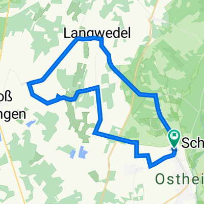
Radwandertag 2024_lang
A cycling route starting in Wahrenholz, Lower Saxony, Germany.
Overview
About this route
- -:--
- Duration
- 18.8 km
- Distance
- 41 m
- Ascent
- 41 m
- Descent
- ---
- Avg. speed
- 69 m
- Max. altitude
Route quality
Waytypes & surfaces along the route
Waytypes
Track
9.2 km
(49 %)
Quiet road
7.7 km
(41 %)
Surfaces
Paved
10.9 km
(58 %)
Unpaved
1.3 km
(7 %)
Asphalt
8.8 km
(47 %)
Paved (undefined)
2.1 km
(11 %)
Continue with Bikemap
Use, edit, or download this cycling route
You would like to ride Radwandertag 2024_lang or customize it for your own trip? Here is what you can do with this Bikemap route:
Free features
- Save this route as favorite or in collections
- Copy & plan your own version of this route
- Sync your route with Garmin or Wahoo
Premium features
Free trial for 3 days, or one-time payment. More about Bikemap Premium.
- Navigate this route on iOS & Android
- Export a GPX / KML file of this route
- Create your custom printout (try it for free)
- Download this route for offline navigation
Discover more Premium features.
Get Bikemap PremiumFrom our community
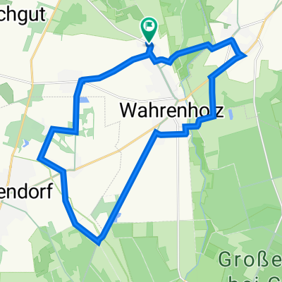
Other popular routes starting in Wahrenholz
 Meine neue Route
- Distance
- 43.1 km
- Ascent
- 101 m
- Descent
- 101 m
- Location
- Wahrenholz, Lower Saxony, Germany
 Radwandertag 2023_lang_version_1
- Distance
- 23.3 km
- Ascent
- 90 m
- Descent
- 93 m
- Location
- Wahrenholz, Lower Saxony, Germany
 Radtour Rund um Ise und Elbe-Seitenkanal - M. Wiescher
- Distance
- 40.6 km
- Ascent
- 178 m
- Descent
- 177 m
- Location
- Wahrenholz, Lower Saxony, Germany
 Wahrenholz-Wolfenbüttel
- Distance
- 70.5 km
- Ascent
- 141 m
- Descent
- 121 m
- Location
- Wahrenholz, Lower Saxony, Germany
 Wahrenholzer Runde
- Distance
- 37.1 km
- Ascent
- 82 m
- Descent
- 82 m
- Location
- Wahrenholz, Lower Saxony, Germany
 Radwandertag 2024_lang
- Distance
- 18.8 km
- Ascent
- 41 m
- Descent
- 41 m
- Location
- Wahrenholz, Lower Saxony, Germany
 ElmTour
- Distance
- 173.5 km
- Ascent
- 503 m
- Descent
- 502 m
- Location
- Wahrenholz, Lower Saxony, Germany
 Heiliger Hain
- Distance
- 32.8 km
- Ascent
- 82 m
- Descent
- 82 m
- Location
- Wahrenholz, Lower Saxony, Germany
Open it in the app