

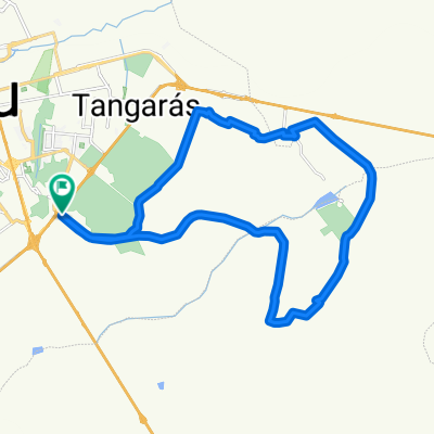
TRILHA DA MOTO
A cycling route starting in Bauru, São Paulo, Brazil.
Overview
About this route
TOTAL SINGLE TRACK, LOTS OF EROSION, MUD AND TREE BRANCHES IN THE MIDDLE OF DENSE FOREST. I DO NOT RECOMMEND GOING ALONE.
- -:--
- Duration
- 18.5 km
- Distance
- 178 m
- Ascent
- 178 m
- Descent
- ---
- Avg. speed
- ---
- Max. altitude

Continue with Bikemap
Use, edit, or download this cycling route
You would like to ride TRILHA DA MOTO or customize it for your own trip? Here is what you can do with this Bikemap route:
Free features
- Save this route as favorite or in collections
- Copy & plan your own version of this route
- Sync your route with Garmin or Wahoo
Premium features
Free trial for 3 days, or one-time payment. More about Bikemap Premium.
- Navigate this route on iOS & Android
- Export a GPX / KML file of this route
- Create your custom printout (try it for free)
- Download this route for offline navigation
Discover more Premium features.
Get Bikemap PremiumFrom our community
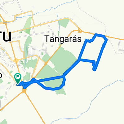
Other popular routes starting in Bauru
 TRILHA DA MOTO
- Distance
- 18.5 km
- Ascent
- 178 m
- Descent
- 178 m
- Location
- Bauru, São Paulo, Brazil
 BAURU LARANJINHA VALE IGAPO FAZENDINHA KIRILANDIA
- Distance
- 34.9 km
- Ascent
- 366 m
- Descent
- 366 m
- Location
- Bauru, São Paulo, Brazil
 VALE IGAPÓ VOLTA PELO LINHÃO
- Distance
- 32 km
- Ascent
- 255 m
- Descent
- 255 m
- Location
- Bauru, São Paulo, Brazil
 Guainás - Duratex - Bauru
- Distance
- 65.8 km
- Ascent
- 570 m
- Descent
- 570 m
- Location
- Bauru, São Paulo, Brazil
 LAGO NESS
- Distance
- 22.6 km
- Ascent
- 225 m
- Descent
- 225 m
- Location
- Bauru, São Paulo, Brazil
 Sustainable Brazil
- Distance
- 172 km
- Ascent
- 1,107 m
- Descent
- 1,152 m
- Location
- Bauru, São Paulo, Brazil
 SESC 01 = Bauru - Piratininga
- Distance
- 26.2 km
- Ascent
- 318 m
- Descent
- 318 m
- Location
- Bauru, São Paulo, Brazil
 Bauru Guaianazes - Chácara do Salim
- Distance
- 38 km
- Ascent
- 298 m
- Descent
- 339 m
- Location
- Bauru, São Paulo, Brazil
Open it in the app