
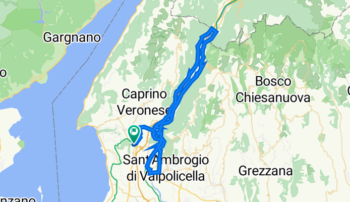
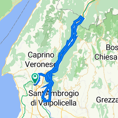
val d'adige e terra dei forti
A cycling route starting in Affi, Veneto, Italy.
Overview
About this route
- -:--
- Duration
- 67.8 km
- Distance
- 836 m
- Ascent
- 836 m
- Descent
- ---
- Avg. speed
- 256 m
- Max. altitude

Route quality
Waytypes & surfaces along the route
Waytypes
Cycleway
23.1 km
(34 %)
Path
17.6 km
(26 %)
Surfaces
Paved
61.7 km
(91 %)
Asphalt
61.7 km
(91 %)
Undefined
6.1 km
(9 %)
Continue with Bikemap
Use, edit, or download this cycling route
You would like to ride val d'adige e terra dei forti or customize it for your own trip? Here is what you can do with this Bikemap route:
Free features
- Save this route as favorite or in collections
- Copy & plan your own version of this route
- Sync your route with Garmin or Wahoo
Premium features
Free trial for 3 days, or one-time payment. More about Bikemap Premium.
- Navigate this route on iOS & Android
- Export a GPX / KML file of this route
- Create your custom printout (try it for free)
- Download this route for offline navigation
Discover more Premium features.
Get Bikemap PremiumFrom our community
Other popular routes starting in Affi
 Affi - San Zeno - Lumini - Affi
- Distance
- 34.3 km
- Ascent
- 551 m
- Descent
- 551 m
- Location
- Affi, Veneto, Italy
 Affi Casteletto Sceriffo
- Distance
- 59.2 km
- Ascent
- 801 m
- Descent
- 801 m
- Location
- Affi, Veneto, Italy
 Affi-Canale-Affi -Rundtour
- Distance
- 19.7 km
- Ascent
- 221 m
- Descent
- 217 m
- Location
- Affi, Veneto, Italy
 Colline sopra Caprino Veronese
- Distance
- 35.7 km
- Ascent
- 804 m
- Descent
- 803 m
- Location
- Affi, Veneto, Italy
 Affi Garda Affi
- Distance
- 63.8 km
- Ascent
- 967 m
- Descent
- 967 m
- Location
- Affi, Veneto, Italy
 Lago & Baldo
- Distance
- 128.5 km
- Ascent
- 1,779 m
- Descent
- 1,779 m
- Location
- Affi, Veneto, Italy
 val d'adige e terra dei forti
- Distance
- 67.8 km
- Ascent
- 836 m
- Descent
- 836 m
- Location
- Affi, Veneto, Italy
 Trailrunde Affi-Caprino
- Distance
- 25.8 km
- Ascent
- 438 m
- Descent
- 438 m
- Location
- Affi, Veneto, Italy
Open it in the app