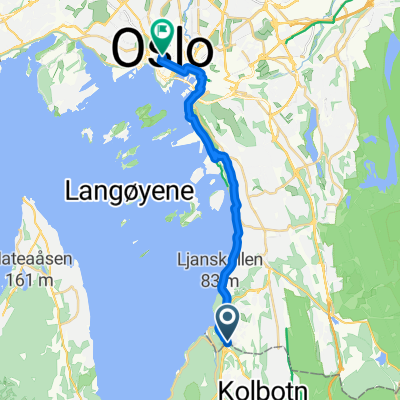
Folloringen
A cycling route starting in Kolbotn, Akershus, Norway.
Overview
About this route
Vakkert landskap, fin miks av grus, asfalt og skogsvei.
- -:--
- Duration
- 90.3 km
- Distance
- 698 m
- Ascent
- 686 m
- Descent
- ---
- Avg. speed
- 187 m
- Avg. speed
Route quality
Waytypes & surfaces along the route
Waytypes
Quiet road
30.1 km
(33 %)
Track
25.3 km
(28 %)
Surfaces
Paved
25.7 km
(28 %)
Unpaved
46.9 km
(52 %)
Gravel
29.8 km
(33 %)
Asphalt
22.7 km
(25 %)
Continue with Bikemap
Use, edit, or download this cycling route
You would like to ride Folloringen or customize it for your own trip? Here is what you can do with this Bikemap route:
Free features
- Save this route as favorite or in collections
- Copy & plan your own version of this route
- Sync your route with Garmin or Wahoo
Premium features
Free trial for 3 days, or one-time payment. More about Bikemap Premium.
- Navigate this route on iOS & Android
- Export a GPX / KML file of this route
- Create your custom printout (try it for free)
- Download this route for offline navigation
Discover more Premium features.
Get Bikemap PremiumFrom our community
Other popular routes starting in Kolbotn
- Ytre rute til Smøgen Lørdag
- Distance
- 230.5 km
- Ascent
- 492 m
- Descent
- 509 m
- Location
- Kolbotn, Akershus, Norway
- route to lake
- Distance
- 45.9 km
- Ascent
- 727 m
- Descent
- 738 m
- Location
- Kolbotn, Akershus, Norway
- Ljabru-Moss havn over sykkelrute 7
- Distance
- 59.1 km
- Ascent
- 317 m
- Descent
- 420 m
- Location
- Kolbotn, Akershus, Norway
- Nøklevann
- Distance
- 20.8 km
- Ascent
- 250 m
- Descent
- 167 m
- Location
- Kolbotn, Akershus, Norway
- Enebakk rundt CLONED FROM ROUTE 166786
- Distance
- 81.5 km
- Ascent
- 430 m
- Descent
- 427 m
- Location
- Kolbotn, Akershus, Norway
- Norwegen 2015 - Oslo -> Horten
- Distance
- 57.5 km
- Ascent
- 238 m
- Descent
- 323 m
- Location
- Kolbotn, Akershus, Norway
- Austmarka rundt
- Distance
- 81.1 km
- Ascent
- 446 m
- Descent
- 446 m
- Location
- Kolbotn, Akershus, Norway
- Rye 15 langtur 17.09.2023
- Distance
- 129.6 km
- Ascent
- 1,613 m
- Descent
- 1,611 m
- Location
- Kolbotn, Akershus, Norway
Open it in the app