
2011 Cycle Tour Rhone Alps - Part 1
A cycling route starting in Trept, Auvergne-Rhône-Alpes, France.
Overview
About this route
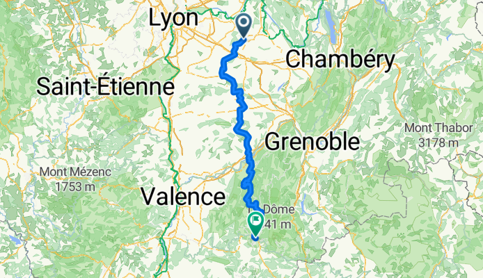
Part one. Lyon to Die. Then took train transfer to Embrun.
- -:--
- Duration
- 178.7 km
- Distance
- 2,546 m
- Ascent
- 2,432 m
- Descent
- ---
- Avg. speed
- ---
- Max. altitude
Route quality
Waytypes & surfaces along the route
Waytypes
Busy road
113.8 km
(64 %)
Road
42.1 km
(24 %)
Surfaces
Paved
95.9 km
(54 %)
Unpaved
1.2 km
(<1 %)
Asphalt
95.9 km
(54 %)
Ground
1 km
(<1 %)
Route highlights
Points of interest along the route
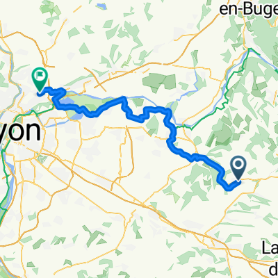
Point of interest after 54.4 km
Night One
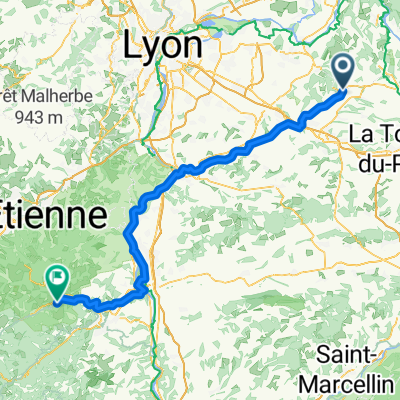
Point of interest after 118.5 km
Night 2
Point of interest after 149.5 km
Night 3
Continue with Bikemap
Use, edit, or download this cycling route
You would like to ride 2011 Cycle Tour Rhone Alps - Part 1 or customize it for your own trip? Here is what you can do with this Bikemap route:
Free features
- Save this route as favorite or in collections
- Copy & plan your own version of this route
- Split it into stages to create a multi-day tour
- Sync your route with Garmin or Wahoo
Premium features
Free trial for 3 days, or one-time payment. More about Bikemap Premium.
- Navigate this route on iOS & Android
- Export a GPX / KML file of this route
- Create your custom printout (try it for free)
- Download this route for offline navigation
Discover more Premium features.
Get Bikemap PremiumFrom our community
Other popular routes starting in Trept
 Route in Dizimieu
- Distance
- 6.8 km
- Ascent
- 131 m
- Descent
- 131 m
- Location
- Trept, Auvergne-Rhône-Alpes, France
 gorges verbois cascade roche
- Distance
- 38.7 km
- Ascent
- 636 m
- Descent
- 635 m
- Location
- Trept, Auvergne-Rhône-Alpes, France
 Trept - Rillieux-la-Pape
- Distance
- 60.3 km
- Ascent
- 414 m
- Descent
- 367 m
- Location
- Trept, Auvergne-Rhône-Alpes, France
 Route to 168 Rue de la Gare, 38460 Vénérieu
- Distance
- 41 km
- Ascent
- 558 m
- Descent
- 559 m
- Location
- Trept, Auvergne-Rhône-Alpes, France
 st marcel veyssilieu moras crémieu
- Distance
- 36 km
- Ascent
- 458 m
- Descent
- 460 m
- Location
- Trept, Auvergne-Rhône-Alpes, France
 2011 Cycle Tour Rhone Alps - Part 1
- Distance
- 178.7 km
- Ascent
- 2,546 m
- Descent
- 2,432 m
- Location
- Trept, Auvergne-Rhône-Alpes, France
 Trept - Bourg-Argental
- Distance
- 109.3 km
- Ascent
- 1,512 m
- Descent
- 1,102 m
- Location
- Trept, Auvergne-Rhône-Alpes, France
 chapoulauds tour
- Distance
- 44.1 km
- Ascent
- 443 m
- Descent
- 444 m
- Location
- Trept, Auvergne-Rhône-Alpes, France
Open it in the app