

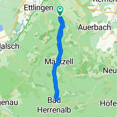
Ettlingen - Spessart - Burbach - Spielberg - Waldbronn
A cycling route starting in Ettlingen, Baden-Württemberg, Germany.
Overview
About this route
Nur für MTB-Fahrer mit Übung.
30 Km Rundweg mit großem Spaßfaktor. 790 Höhenmeter mit teilweise beachtlicher Steigung. Von Schwimmbad Ettlingen geht es über eine Strecke von 2 km um 235hm hinauf. Zwischen Spessart und Schöllbronn führt ein Pfad entlang des Waldrandes zum "Toter Mann Trail" hinunter nach Fischweier. Von dort wieder steil bergauf Richtung Burbach.
Nach Marxzell dann noch am Brandkopf den Linienweg hinunter Richtung Spielberg und Etzenrot. Wer will kann am Ortsende von Etzenrot abkürzen und zur Haltestelle "Waldbronn Kurpark" fahren (S11).
Ab Busenbach kommt nochmal Spaß auf, wenn die Strecke zum Wattkopf Sendeturm führt um von dort über Trampelpfade hinab ins Albtal zu "stürzen". Viel Spaß, und denkt daran: Schweiß ist Schwäche, die den Körper verlässt" :-))
- -:--
- Duration
- 31 km
- Distance
- 746 m
- Ascent
- 746 m
- Descent
- ---
- Avg. speed
- ---
- Max. altitude

Continue with Bikemap
Use, edit, or download this cycling route
You would like to ride Ettlingen - Spessart - Burbach - Spielberg - Waldbronn or customize it for your own trip? Here is what you can do with this Bikemap route:
Free features
- Save this route as favorite or in collections
- Copy & plan your own version of this route
- Sync your route with Garmin or Wahoo
Premium features
Free trial for 3 days, or one-time payment. More about Bikemap Premium.
- Navigate this route on iOS & Android
- Export a GPX / KML file of this route
- Create your custom printout (try it for free)
- Download this route for offline navigation
Discover more Premium features.
Get Bikemap PremiumFrom our community
Other popular routes starting in Ettlingen
 Karlsbad Rundtour
- Distance
- 25.2 km
- Ascent
- 210 m
- Descent
- 283 m
- Location
- Ettlingen, Baden-Württemberg, Germany
 Albtal
- Distance
- 28.8 km
- Ascent
- 552 m
- Descent
- 554 m
- Location
- Ettlingen, Baden-Württemberg, Germany
 ka - spessart - burbach - dobel - turmberg
- Distance
- 77.7 km
- Ascent
- 900 m
- Descent
- 900 m
- Location
- Ettlingen, Baden-Württemberg, Germany
 Ettlingen-Teufelsmühle-Ettlingen
- Distance
- 70.6 km
- Ascent
- 973 m
- Descent
- 973 m
- Location
- Ettlingen, Baden-Württemberg, Germany
 Karlsbad-Schwanner Warte-Ellmendingen
- Distance
- 29.8 km
- Ascent
- 406 m
- Descent
- 409 m
- Location
- Ettlingen, Baden-Württemberg, Germany
 Kleine Moosalbtalrunde
- Distance
- 25.8 km
- Ascent
- 444 m
- Descent
- 451 m
- Location
- Ettlingen, Baden-Württemberg, Germany
 Ettlingen - Teufelsmühle - Dobel - Ettlingen
- Distance
- 75.1 km
- Ascent
- 1,074 m
- Descent
- 1,074 m
- Location
- Ettlingen, Baden-Württemberg, Germany
 Ettlingen -> Hohloh -> Dobel -> Teufelsmühle -> Ettlingen
- Distance
- 129.1 km
- Ascent
- 2,550 m
- Descent
- 2,238 m
- Location
- Ettlingen, Baden-Württemberg, Germany
Open it in the app