

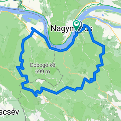
Visegrád-Tahitóthfalu-Visegrád
A cycling route starting in Visegrád, Pest County, Hungary.
Overview
About this route
- -:--
- Duration
- 42.1 km
- Distance
- 548 m
- Ascent
- 549 m
- Descent
- ---
- Avg. speed
- 519 m
- Max. altitude

Route quality
Waytypes & surfaces along the route
Waytypes
Cycleway
14.3 km
(34 %)
Quiet road
10.9 km
(26 %)
Surfaces
Paved
32.4 km
(77 %)
Unpaved
8 km
(19 %)
Asphalt
28.2 km
(67 %)
Ground
6.3 km
(15 %)
Continue with Bikemap
Use, edit, or download this cycling route
You would like to ride Visegrád-Tahitóthfalu-Visegrád or customize it for your own trip? Here is what you can do with this Bikemap route:
Free features
- Save this route as favorite or in collections
- Copy & plan your own version of this route
- Sync your route with Garmin or Wahoo
Premium features
Free trial for 3 days, or one-time payment. More about Bikemap Premium.
- Navigate this route on iOS & Android
- Export a GPX / KML file of this route
- Create your custom printout (try it for free)
- Download this route for offline navigation
Discover more Premium features.
Get Bikemap PremiumFrom our community
Other popular routes starting in Visegrád
 Esztergomi út, Visegrád - Nagymaros-Nógrád, Nagymaros
- Distance
- 6.7 km
- Ascent
- 400 m
- Descent
- 25 m
- Location
- Visegrád, Pest County, Hungary
 Visegrádi híd. - Névtelen Út
- Distance
- 13.9 km
- Ascent
- 779 m
- Descent
- 397 m
- Location
- Visegrád, Pest County, Hungary
 Visegrád-Tahitóthfalu-Visegrád
- Distance
- 42.1 km
- Ascent
- 548 m
- Descent
- 549 m
- Location
- Visegrád, Pest County, Hungary
 Visegrád-Visegrád
- Distance
- 59.4 km
- Ascent
- 1,751 m
- Descent
- 1,758 m
- Location
- Visegrád, Pest County, Hungary
![[Horizont] 15. Visegrád - Budapest](https://media.bikemap.net/routes/17441261/staticmaps/in_91fb7390-d294-438c-8d7b-2550d6299f16_400x400_bikemap-2021-3D-static.png) [Horizont] 15. Visegrád - Budapest
[Horizont] 15. Visegrád - Budapest- Distance
- 62.5 km
- Ascent
- 1,101 m
- Descent
- 1,071 m
- Location
- Visegrád, Pest County, Hungary
 Fő utca - Szabadság utca
- Distance
- 61.5 km
- Ascent
- 375 m
- Descent
- 399 m
- Location
- Visegrád, Pest County, Hungary
 Esztergomi út, Visegrád - Nagymaros-Nógrád, Nagymaros
- Distance
- 5.7 km
- Ascent
- 384 m
- Descent
- 23 m
- Location
- Visegrád, Pest County, Hungary
 Útvonal ide: Ady Endre út
- Distance
- 46.2 km
- Ascent
- 530 m
- Descent
- 567 m
- Location
- Visegrád, Pest County, Hungary
Open it in the app