

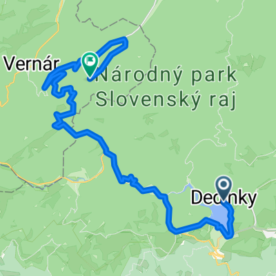
Poprad - Eger 3. deň
A cycling route starting in Dobšiná, Košice Region, Slovakia.
Overview
About this route
From Dediniek to Rakovec along the road. In Rakovec turn right over the railway onto the asphalted forest path and follow it up to the Súľová saddle. Here we connect to the state road which takes us to Gemerská Poloma. Here we turn towards Dobšiná and continue until after the village of Henckovce, where we take the side road through the Filipka saddle through Roštár, Štítnik to Plešivec.
From Plešivec, we head towards Domica, cross the state border, and near the Aggtelek cave, a well-equipped campsite awaits us.
A large part of the route is also marked in the terrain as a cycle tourism path!
- -:--
- Duration
- 77.5 km
- Distance
- 841 m
- Ascent
- 1,302 m
- Descent
- ---
- Avg. speed
- ---
- Max. altitude

Route highlights
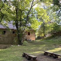
Points of interest along the route
Point of interest after 32.2 km
Point of interest after 32.3 km
Continue with Bikemap
Use, edit, or download this cycling route
You would like to ride Poprad - Eger 3. deň or customize it for your own trip? Here is what you can do with this Bikemap route:
Free features
- Save this route as favorite or in collections
- Copy & plan your own version of this route
- Sync your route with Garmin or Wahoo
Premium features
Free trial for 3 days, or one-time payment. More about Bikemap Premium.
- Navigate this route on iOS & Android
- Export a GPX / KML file of this route
- Create your custom printout (try it for free)
- Download this route for offline navigation
Discover more Premium features.
Get Bikemap PremiumFrom our community
Other popular routes starting in Dobšiná
 Zelená stuha Horehronia
- Distance
- 54.8 km
- Ascent
- 979 m
- Descent
- 1,246 m
- Location
- Dobšiná, Košice Region, Slovakia
 Telgárt, Telgárt až Muráň
- Distance
- 21.6 km
- Ascent
- 667 m
- Descent
- 694 m
- Location
- Dobšiná, Košice Region, Slovakia
 Dedinky- Stratená- s.Kopanec- Blajszloch
- Distance
- 26.3 km
- Ascent
- 4,768 m
- Descent
- 4,787 m
- Location
- Dobšiná, Košice Region, Slovakia
 Sporty route
- Distance
- 82.1 km
- Ascent
- 43 m
- Descent
- 474 m
- Location
- Dobšiná, Košice Region, Slovakia
 Iglói kör
- Distance
- 64.7 km
- Ascent
- 958 m
- Descent
- 957 m
- Location
- Dobšiná, Košice Region, Slovakia
 Telgárt, Telgárt až Telgárt, Telgárt
- Distance
- 48.5 km
- Ascent
- 1,792 m
- Descent
- 1,791 m
- Location
- Dobšiná, Košice Region, Slovakia
 Telgart - Palcmanska masa
- Distance
- 45.9 km
- Ascent
- 571 m
- Descent
- 568 m
- Location
- Dobšiná, Košice Region, Slovakia
 Kráľovohoľská cesta, Šumiac do Šumiac
- Distance
- 11.5 km
- Ascent
- 1,025 m
- Descent
- 33 m
- Location
- Dobšiná, Košice Region, Slovakia
Open it in the app