

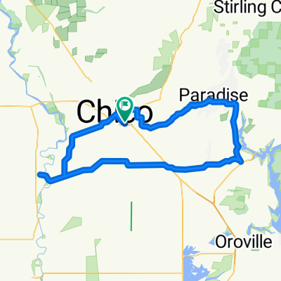
Climb to Paradise
A cycling route starting in Chico, California, United States.
Overview
About this route
We ride on a bike path that doesn't seem to be on this map from 20th over to the road up to Paradies, and take a left at the turn to Centerville. Rough pavement at the top, but a lovely climb.
- -:--
- Duration
- 21.8 km
- Distance
- 511 m
- Ascent
- 64 m
- Descent
- ---
- Avg. speed
- ---
- Max. altitude
Continue with Bikemap
Use, edit, or download this cycling route
You would like to ride Climb to Paradise or customize it for your own trip? Here is what you can do with this Bikemap route:
Free features
- Save this route as favorite or in collections
- Copy & plan your own version of this route
- Sync your route with Garmin or Wahoo
Premium features
Free trial for 3 days, or one-time payment. More about Bikemap Premium.
- Navigate this route on iOS & Android
- Export a GPX / KML file of this route
- Create your custom printout (try it for free)
- Download this route for offline navigation
Discover more Premium features.
Get Bikemap PremiumFrom our community
Other popular routes starting in Chico
 2012 Lassen Trip Final Route
- Distance
- 506.4 km
- Ascent
- 3,923 m
- Descent
- 3,925 m
- Location
- Chico, California, United States
 Trial Route
- Distance
- 7 km
- Ascent
- 21 m
- Descent
- 21 m
- Location
- Chico, California, United States
 Lassen/Eaton/Route
- Distance
- 13.7 km
- Ascent
- 14 m
- Descent
- 14 m
- Location
- Chico, California, United States
 Climb to Paradise
- Distance
- 21.8 km
- Ascent
- 511 m
- Descent
- 64 m
- Location
- Chico, California, United States
 1- Mile - Butte College - Flag Creek Road
- Distance
- 33.9 km
- Ascent
- 226 m
- Descent
- 58 m
- Location
- Chico, California, United States
 Chico Mild-Flower
- Distance
- 109.4 km
- Ascent
- 799 m
- Descent
- 809 m
- Location
- Chico, California, United States
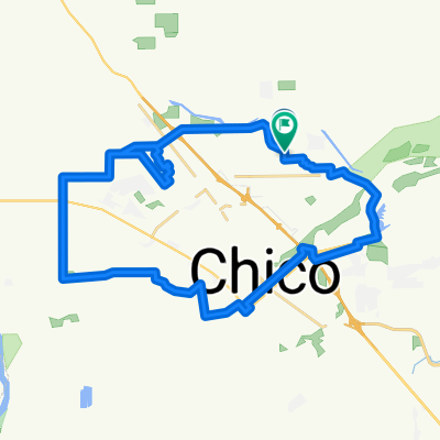
 Scenic Tour Through Bidwell Park
- Distance
- 11 km
- Ascent
- 87 m
- Descent
- 97 m
- Location
- Chico, California, United States
 Chico Circle
- Distance
- 39 km
- Ascent
- 52 m
- Descent
- 52 m
- Location
- Chico, California, United States
Open it in the app