
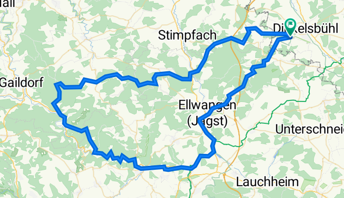
Segringen -Sulzbach-Laufen- Segringen
A cycling route starting in Dinkelsbühl, Bavaria, Germany.
Overview
About this route
- -:--
- Duration
- 111 km
- Distance
- 1,486 m
- Ascent
- 1,486 m
- Descent
- ---
- Avg. speed
- 576 m
- Max. altitude

Route quality
Waytypes & surfaces along the route
Waytypes
Quiet road
32.3 km
(29 %)
Track
31.5 km
(28 %)
Surfaces
Paved
57.3 km
(52 %)
Unpaved
18.3 km
(16 %)
Asphalt
48.2 km
(43 %)
Gravel
18.3 km
(16 %)
Continue with Bikemap
Use, edit, or download this cycling route
You would like to ride Segringen -Sulzbach-Laufen- Segringen or customize it for your own trip? Here is what you can do with this Bikemap route:
Free features
- Save this route as favorite or in collections
- Copy & plan your own version of this route
- Split it into stages to create a multi-day tour
- Sync your route with Garmin or Wahoo
Premium features
Free trial for 3 days, or one-time payment. More about Bikemap Premium.
- Navigate this route on iOS & Android
- Export a GPX / KML file of this route
- Create your custom printout (try it for free)
- Download this route for offline navigation
Discover more Premium features.
Get Bikemap PremiumFrom our community
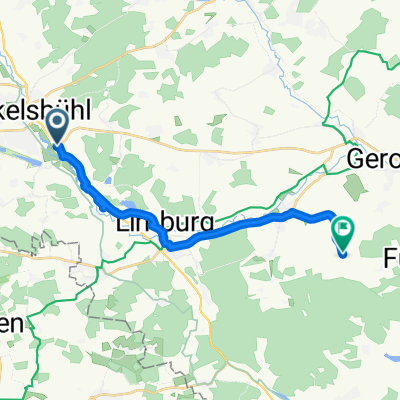
Other popular routes starting in Dinkelsbühl
 D-B 10 a Dinkelsbuehl - Rothenburg
- Distance
- 47.4 km
- Ascent
- 263 m
- Descent
- 294 m
- Location
- Dinkelsbühl, Bavaria, Germany
 Runde um den Hesselberg
- Distance
- 67 km
- Ascent
- 337 m
- Descent
- 333 m
- Location
- Dinkelsbühl, Bavaria, Germany
 Dinkelsbühl Tour 10 Limes-Tour
- Distance
- 39.8 km
- Ascent
- 195 m
- Descent
- 198 m
- Location
- Dinkelsbühl, Bavaria, Germany
 Mutschach mit Kindern
- Distance
- 9.2 km
- Ascent
- 110 m
- Descent
- 112 m
- Location
- Dinkelsbühl, Bavaria, Germany
 Sonntagstour - für Kaffee und Kuchen
- Distance
- 16.2 km
- Ascent
- 108 m
- Descent
- 107 m
- Location
- Dinkelsbühl, Bavaria, Germany
 3.1_Dinkelsbuehl - Donauwoerth
- Distance
- 74.2 km
- Ascent
- 147 m
- Descent
- 190 m
- Location
- Dinkelsbühl, Bavaria, Germany
 Badetour DKB Frankenhofen
- Distance
- 15.2 km
- Ascent
- 105 m
- Descent
- 66 m
- Location
- Dinkelsbühl, Bavaria, Germany
 Dinkelsbühl Tour 06 wenn wir erklimmen
- Distance
- 36.1 km
- Ascent
- 205 m
- Descent
- 202 m
- Location
- Dinkelsbühl, Bavaria, Germany
Open it in the app