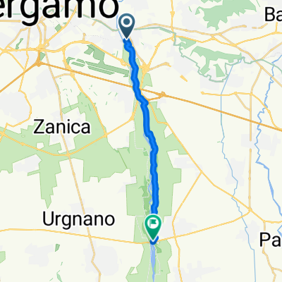
not so easy 2024 Italy
A cycling route starting in Seriate, Lombardy, Italy.
Overview
About this route
- 60 h 24 min
- Duration
- 734 km
- Distance
- 12,622 m
- Ascent
- 12,869 m
- Descent
- 12.2 km/h
- Avg. speed
- 2,224 m
- Avg. speed
Route quality
Waytypes & surfaces along the route
Waytypes
Quiet road
195.2 km
(27 %)
Cycleway
175.2 km
(24 %)
Surfaces
Paved
537.2 km
(73 %)
Unpaved
63.2 km
(9 %)
Asphalt
517.8 km
(71 %)
Gravel
31 km
(4 %)
Route highlights
Points of interest along the route
Accommodation after 65 km
Olivella camp
Accommodation after 156.8 km
Venus camping
Accommodation after 167.1 km
Camp
Accommodation after 192.5 km
Azzuro
Accommodation after 212.3 km
Accommodation after 231.8 km
Camping Diano
Point of interest after 238.1 km
Castello toblino
Accommodation after 250.6 km
Lido Lilla\ Camping
Accommodation after 292.4 km
Accommodation after 342.2 km
Camping Seiser Alm
Point of interest after 360.8 km
Seceda
Photo after 360.8 km
16 km https://www.alltrails.com/explore/trail/italy/south-tyrol/giro-del-gruppo-del-sassolungo?mobileMap=false&ref=sidebar-static-map
Accommodation after 382.7 km
Photo after 401.7 km
10 km https://www.alltrails.com/explore/trail/italy/south-tyrol/seceda-malga-pieralongia-rifugio-firenze-baita-troier
Photo after 405.2 km
10 km https://www.alltrails.com/explore/trail/italy/south-tyrol/via-delle-odle-zanser-alm-rifugio-delle-odle-malga-dusler
Accommodation after 405.2 km
Camping Calfosch Almi
Point of interest after 405.2 km
Accommodation after 437 km
Löwenhof
Accommodation after 469.5 km
Camping Ansitz Wildberg
Accommodation after 485.8 km
Accommodation after 518.5 km
Accommodation after 523.4 km
Camping Toblacher See
Photo after 546 km
3.4 +10 km tai 15 https://www.alltrails.com/explore/trail/italy/veneto/tre-cime-di-lavaredo-drei-zinnen https://www.alltrails.com/explore/trail/italy/south-tyrol/monte-paterno-forcella-pian-di-cengia-tre-cime-di-lavaredo
Accommodation after 552.9 km
Alla Baita camp
Photo after 560.9 km
https://www.alltrails.com/explore/trail/italy/veneto/rifugio-cristallo-lago-sorapis-rifugio-vandelli-passo-tre-croci
Accommodation after 570 km
Camping Rocchetta
Accommodation after 570.7 km
Camping Dolomiti
Accommodation after 643.4 km
Sarathei
Continue with Bikemap
Use, edit, or download this cycling route
You would like to ride not so easy 2024 Italy or customize it for your own trip? Here is what you can do with this Bikemap route:
Free features
- Save this route as favorite or in collections
- Copy & plan your own version of this route
- Sync your route with Garmin or Wahoo
Premium features
Free trial for 3 days, or one-time payment. More about Bikemap Premium.
- Navigate this route on iOS & Android
- Export a GPX / KML file of this route
- Create your custom printout (try it for free)
- Download this route for offline navigation
Discover more Premium features.
Get Bikemap PremiumFrom our community
Other popular routes starting in Seriate
- easy 2024 Italy
- Distance
- 600.2 km
- Ascent
- 7,693 m
- Descent
- 7,941 m
- Location
- Seriate, Lombardy, Italy
- not so easy 2024 Italy
- Distance
- 734 km
- Ascent
- 12,622 m
- Descent
- 12,869 m
- Location
- Seriate, Lombardy, Italy
- Colli di Bergamo
- Distance
- 41.2 km
- Ascent
- 419 m
- Descent
- 420 m
- Location
- Seriate, Lombardy, Italy
- selvino da algua
- Distance
- 77.2 km
- Ascent
- 1,164 m
- Descent
- 1,165 m
- Location
- Seriate, Lombardy, Italy
- Seriate-San Fermo
- Distance
- 63.3 km
- Ascent
- 1,250 m
- Descent
- 1,252 m
- Location
- Seriate, Lombardy, Italy
- Da Via Giacomo Leopardi 10, Seriate a Via Giacomo Leopardi 10, Seriate
- Distance
- 17.2 km
- Ascent
- 343 m
- Descent
- 86 m
- Location
- Seriate, Lombardy, Italy
- Anello del Parco del Serio
- Distance
- 49.2 km
- Ascent
- 136 m
- Descent
- 140 m
- Location
- Seriate, Lombardy, Italy
- Passeggiatina con Bimbi Scuole di Seriate
- Distance
- 10.4 km
- Ascent
- 9 m
- Descent
- 66 m
- Location
- Seriate, Lombardy, Italy
Open it in the app